
Our stay in La Paz was short – only one and a half days to resupply, eat some decent food, do some bike maintenance and re-re-plan our route to San Pedro de Atacama, where we would be meeting our friend Annie on quite a tight timescale. The city itself is a polluted, chaotic mess, so we weren’t too bummed at spending such a short amount of time there. On a positive note, El, social organiser extraordinaire, managed to corral 12 bike tourers together for our biggest, most social meal out yet! It was great to meet a few new faces among those we’ve been hopscotching for a while now and discuss our onward plans.
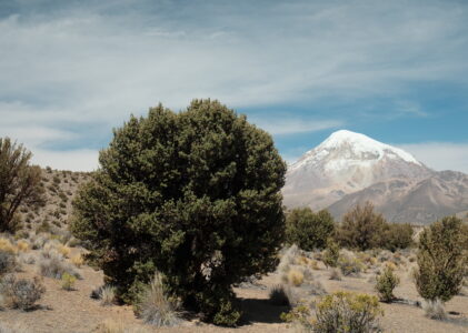
Speaking of those, our next target on this journey would be Sajama National Park in the far west of Bolivia, right on the border with Chile. This park contains Bolivia’s highest mountain of the same name, but the real reason behind the creation of the park in 1939 (old!) was the protection of the Quewiñas (Polylepis) forest which cover its slopes. These “forests” are famous for being some of the highest in the world, but are under significant pressure from being chopped down for firewood.
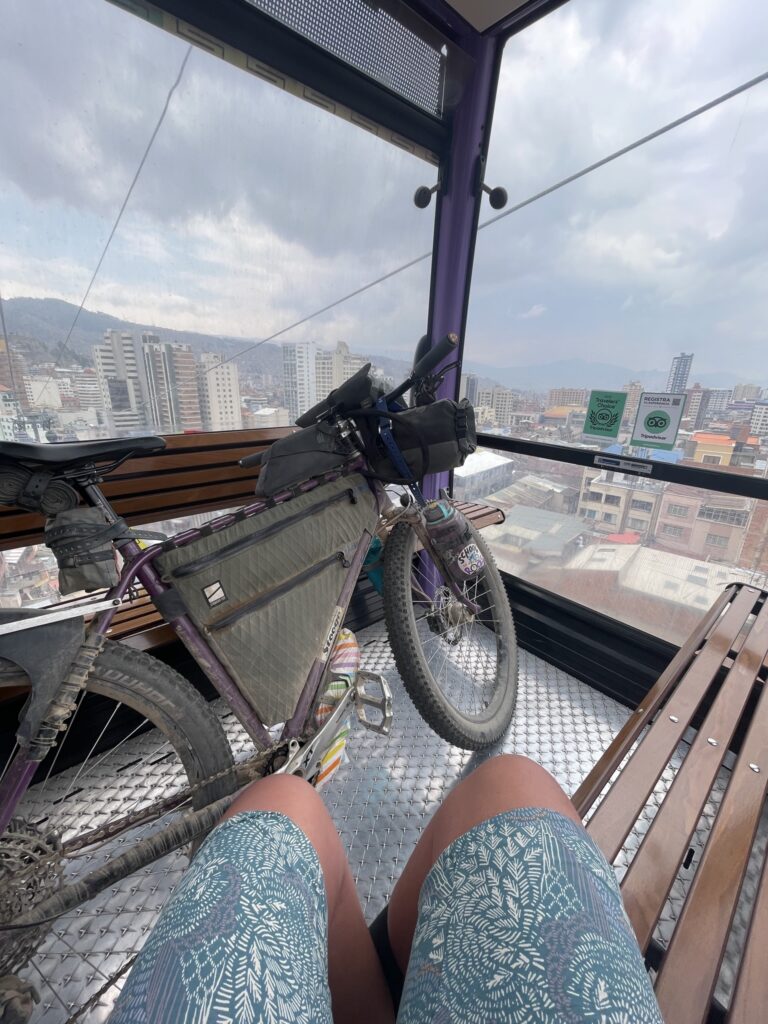
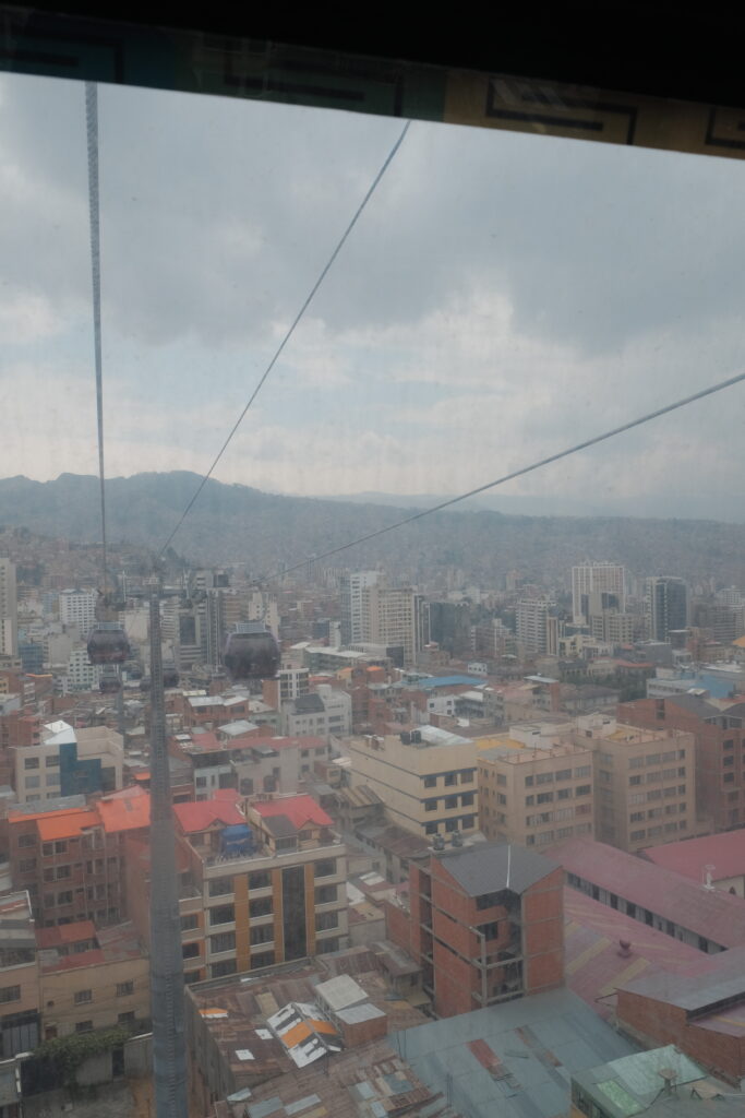
Our route route to the park would take us first, up to the rim of La Paz using the excellent cable car system, then cross country through a fairly blank area of the map before intersecting highway 4 and riding that until the dirt track which enters the park from the East.
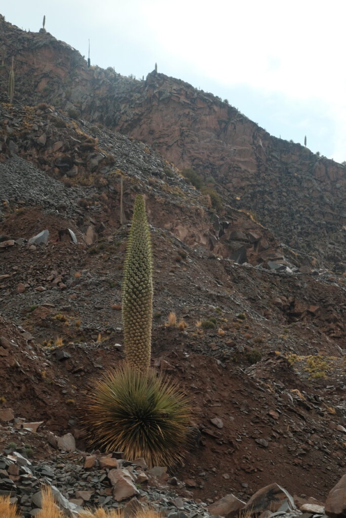
Our first day exiting La Paz was a pleasant surprise – after some trepidation at getting our bikes onto the cable car and the potential traffic on the surrounding roads, it was all very easy and we cruised down an empty, wide road into Viacha for lunch. Assuming the tarmac would run out then, we were pleasantly surprised once again to find that it kept going and we made unexpectedly good progress that afternoon, passing through Comanche and its flowering Puya raimondii plants incongruously sprouting in the middle of an active quarry! El got particularly excited by this as they don’t flower very often, when the Puya at the National Botanic Garden of Wales flowered it made the national news!


The tarmac continued the following day to the mining outpost of Coro Coro, where it transitioned to dirt. The landscapes this day reminded us a lot of the Tatacoa desert in Colombia – dark red earth sculpted into intricate shapes by the wind and the (very occasional) rain.

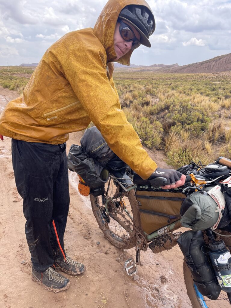
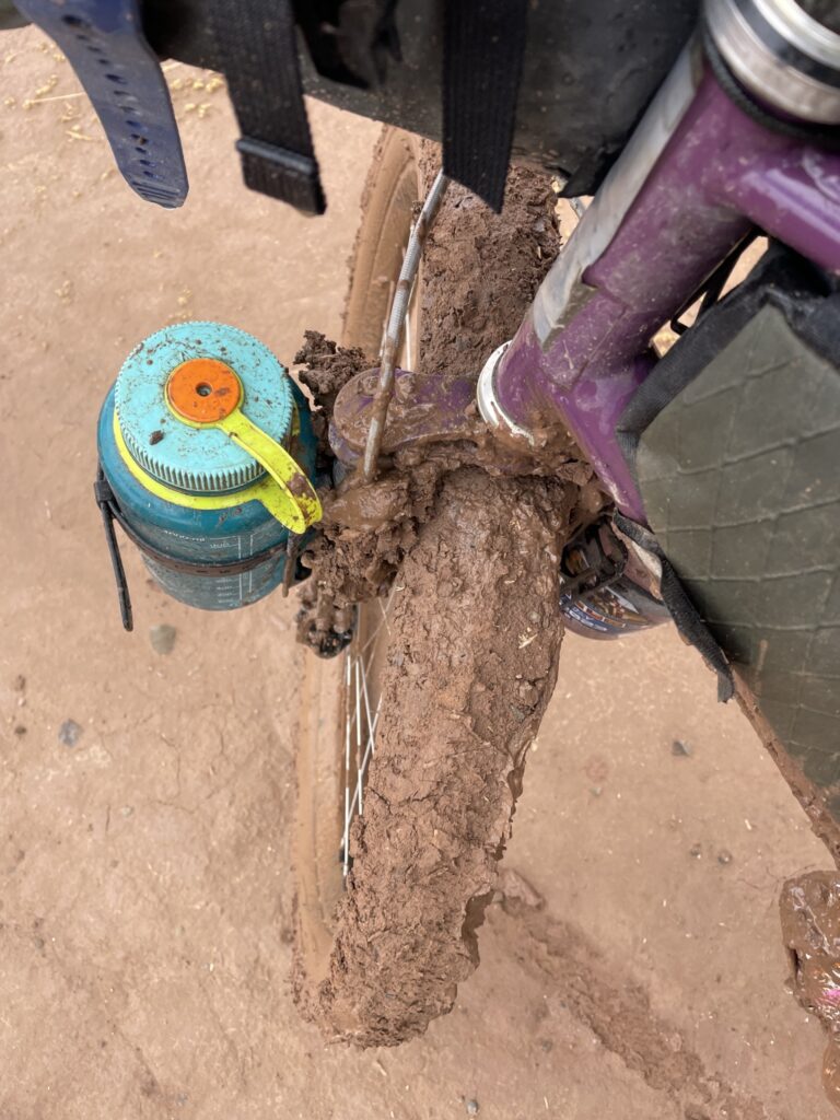
We stopped for lunch by a small stream but had to hastily finish our sandwiches as we got hit by an isolated squall of rain. At this point, we should have just waited for everything to dry out, but instead we continued riding. 5 minutes later our bikes were completed clogged in and forward progress was no longer possible. 1 hour of bike washing in a muddy stream later, and we were finally ready to go again. You live and you learn, I guess – when the death mud strikes, just stop.
That afternoon, we were chased by further thunderstorms into the shabby down of Santiago de Callapa, where we took refuge in a small shop. The storm seemed to hover on the edge of town, never quite making any progress, and so eventually, we grabbed our bikes and headed off via a water refill from a tap on the edge of town. Oh, how we would come to regret this water stop!
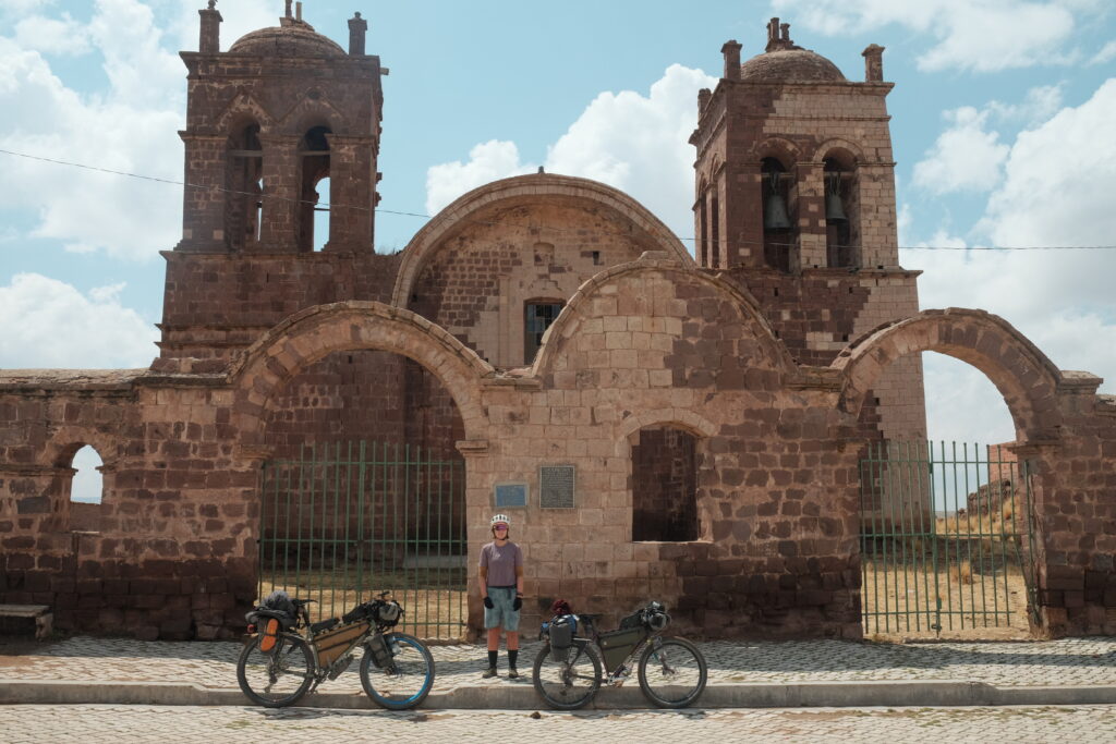
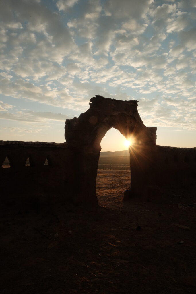
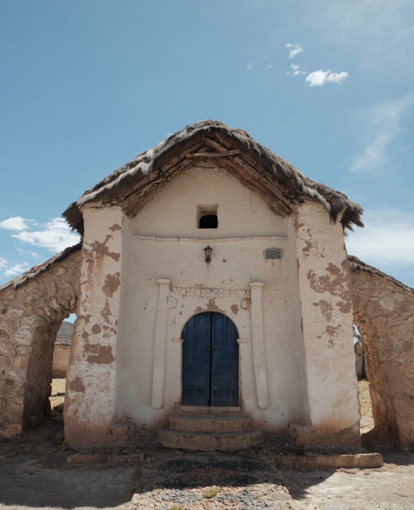
That night, we slept in the grounds of a old Jesuit mission church which had mostly been burned down by a lightning strike! They have since fitted a lightning rod and earthing cable just visible on the left hand turret.


The following morning, El was in a bad state having been up several times in the night to empty her bowels. We crawled down highway 4 to the town of Curahuara de Carangas and straight into Hostel Kory Wara. We would only emerge 4 days later, both struck down by the worst diarrhoea of our lives! We were very lucky to have found this hostel which was cheap, quiet and had good enough Wi-Fi that we could binge watch some tv to pass the time. All it was missing was a hot shower, but for a middle of nowhere Bolivian town, you couldn’t ask for better, really.
4 days later and we were tentatively back on the road, making our way to Sajama once again.
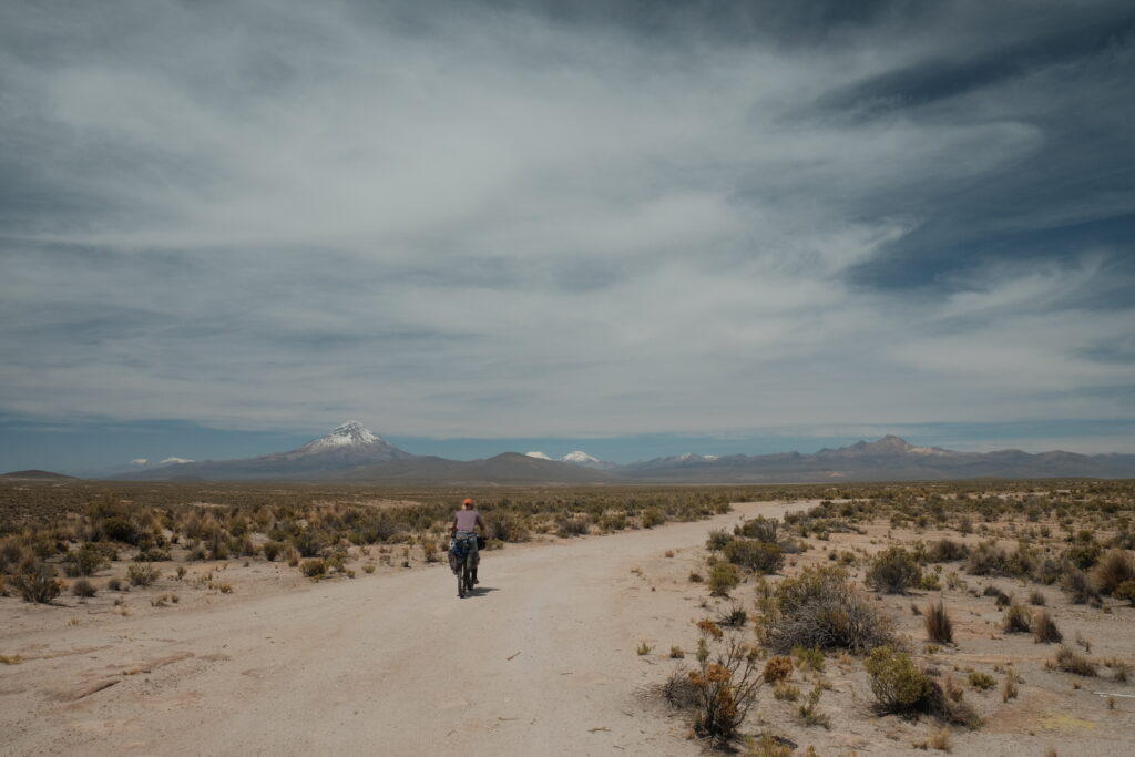

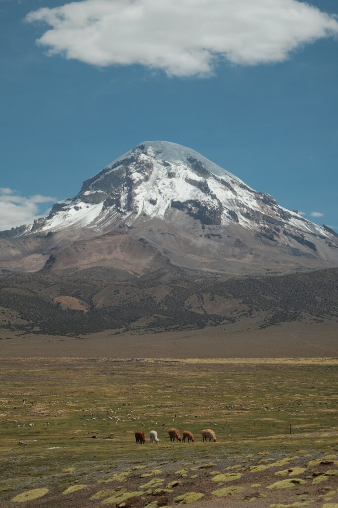

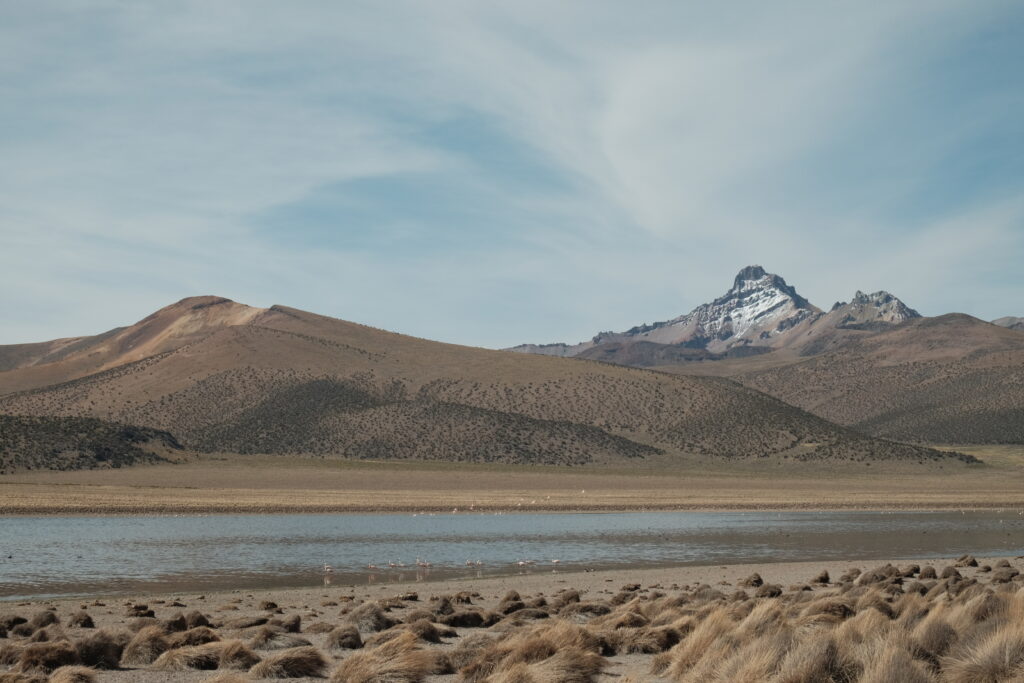
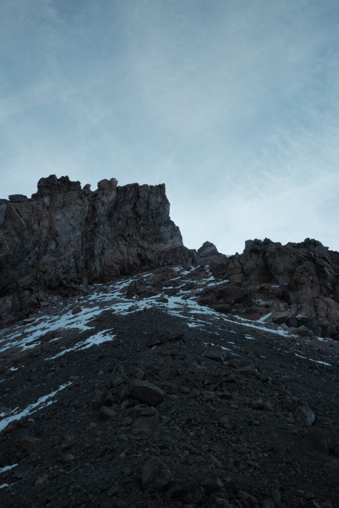
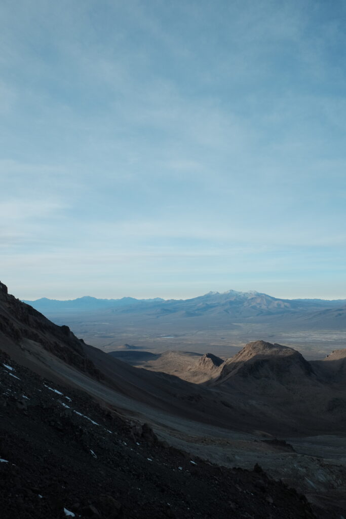
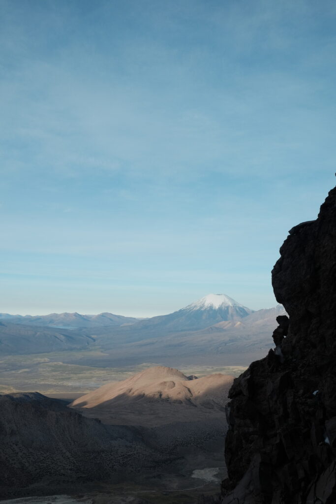
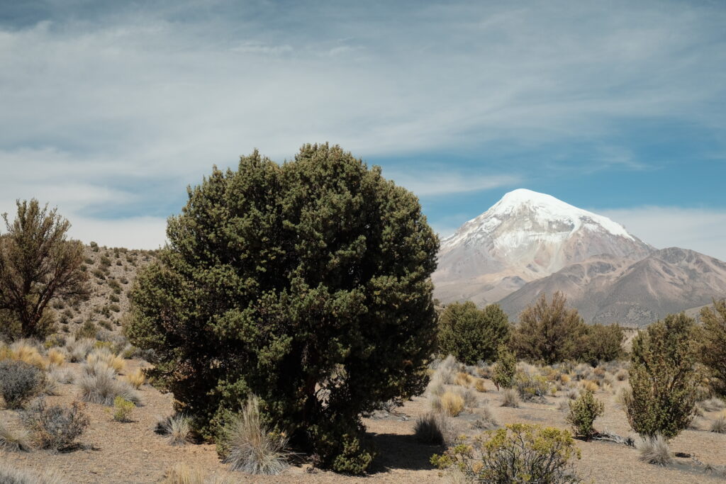
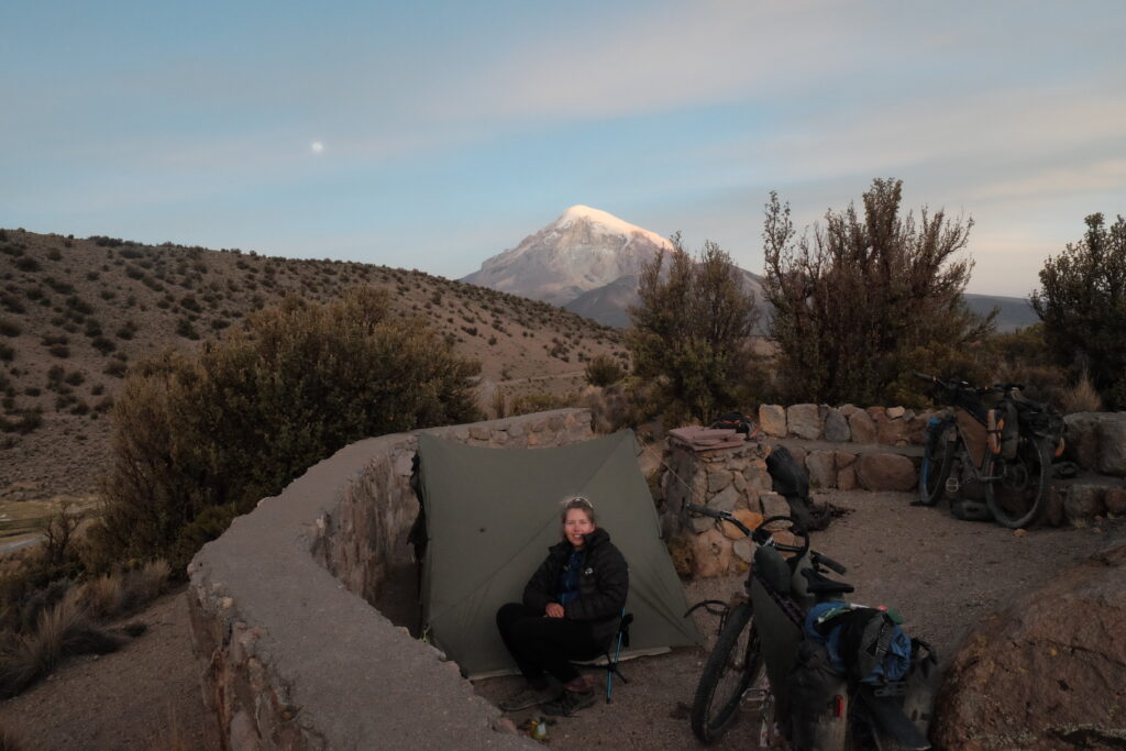
That night, we camped at the base of Volcan Sajama, sheltering behind a Quewiñas tree from the wind, which had picked up significantly through the afternoon. The following morning, I was up at 4am to see how high I could get up the mountain. With goals to climb some of the volcanos on the Seis Miles route in the Puna de Atacama looming, this was a key little test for me to get an idea for an expected ascent rate at these altitudes and also get a feel for how cold it could be. It was all going well until I made a bit of a route finding blunder above the high camp and had to scramble up a heinous 50 degree scree slope on my hands and knees, every other footstep collapsing beneath me. I was relieved to get to solid rock by a small col and called it a day there at 5600m – I’d reached the start of the snow line and time was getting on.

Back at camp for breakfast at 8am, I was pretty happy with my effort, considering that I’d been chained to the toilet only 2 days previous! (I wasn’t out of the diarrhoea hole yet, though). Those that know me will also know that I’ve really struggled to run at all since racing the Highland Trail 550 in 2021, where I gave myself nerve damage in my legs and couldn’t even run a mile for a year afterwards. That morning’s 17km was, by far, the longest walk/run I had done since that race, 2.5 years ago. I think our 9 day trek to Machu Picchu somehow caused a reconfiguration of my nervous system such that my calf muscles were finally firing in a properly coordinated way. Two years of various specialists, scans and tests, and all that was needed was a multi-day trek with a bunch of weight on my back!
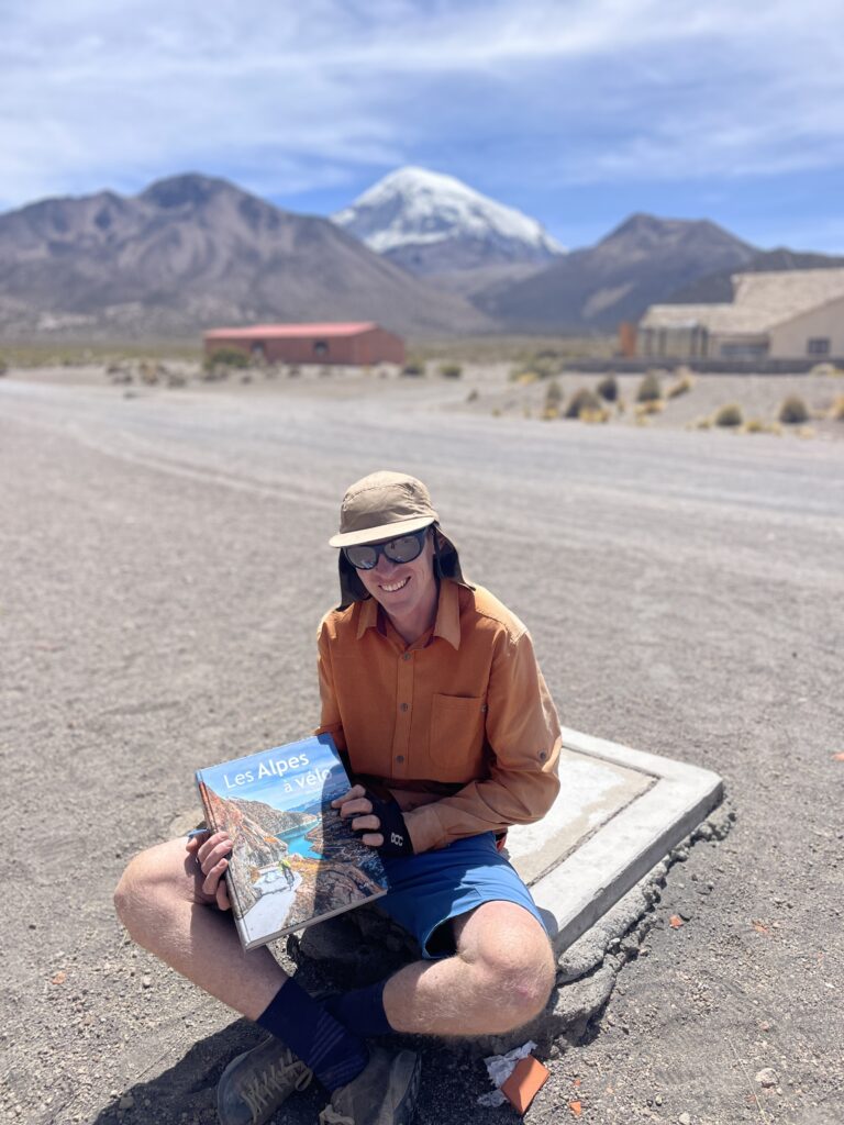
We’d planned an easy day in the park that day, hoping to spend most of our time at the famous geysers. We filled up water from a tap in Sajama town and were promptly descended upon by a Swiss expat retiree! Not who we were expecting to find! He very excitedly showed us a book he had about cycling in the Alps and then acted as our concierge, showing us the best shop in town and pointing us to a restaurant where we could get an early almuerzo.

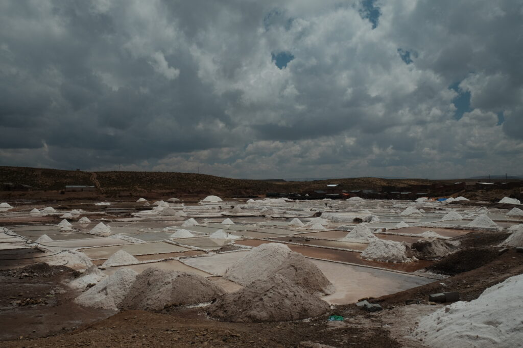
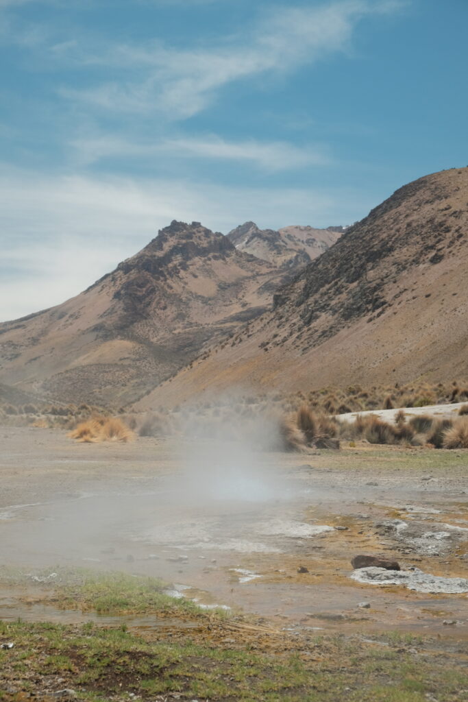
We headed up to the geysers that afternoon and spent the rest of the day relaxing and generally blissing out in the small stream that runs through the geyser field. Since all the geysers run into the river, the temperature increases the further downstream one goes, so its just a case of picking a spot with a temperature that suits. It is such a cool spot, and by far the nicest “hot springs” we have been to on our trip so far. Most of them tend to consist of a concrete pool with hot water piped in, whereas this was completely natural and pretty much deserted!


The wind was ferocious that afternoon and, unusually, showed no signs of abating as the evening progressed, so we ended up squeezing out tent into the little picnic area that overlooks the geysers. Good thing too, as the wind kept going all night. Plus, it afforded us a great view of Sajama mountain and ensured that the sun hit is early in the morning – always an important consideration when the mercury drops below zero every night.
From here, we would be crossing into Chile to ride the Ruta de la Vicuñas, before crossing back into Bolivia and traversing the famous salt flats, though that’s a topic for the next blog post.
Routes
If you’re interested in our routes, you can find them all on our trip homepage.
I enjoy following your travels. It brings back great memories. Life back in Vancouver is relaxing for now. A much needed rest until the snow flies and we strap on our skis. Enjoy Bolivia. It is hard but so worth it. Dan