Way back when I was planning our initial Colombia route, I had eyed up the crossing of the Cordillera Central between Roncesvalles and Valle de Cauca, including it in our first-first-draft route. This “road” doesn’t even exist in Google Maps, only on OSM, so it was always a tentative inclusion.
Now that we had had to bin our plans for an anti-clockwise loop around Nevado del Ruiz due to volcanic activity, this pass suddenly became crucial to getting back into the Magdalena valley after our east to west crossing of La Linea. Internet searches for “Roncesvalles”, “mtb” and “bikepacking” had yielded no results; all I could find to confirm the existence of this route on the ground were a handful of moto and quad tracks on Wikiloc.
Spoiler alert: the route goes and is, we both agree, the best riding we have done to date in Colombia. Here’s the story of our second crossing of the Cordillera Central.
After our somewhat stressful escape from Armenia under the cover of darkness described in our previous post, at least we were starting the day at the foot of our first objective, the town of Buenavista. We had heard that it was nice from fellow Bristolian and South America bike-tourer Joe Sasada and that was as good an excuse as any to pay a visit. On the climb up, we were joined by an American chap (sorry, forgot your name), who had moved to Colombia a few years ago.
“Do you miss the seasons?”, we asked.
“Aw, heck no!”
He recommended a coffee place just before Buenavista called San Alfonso, saying it was the best coffee around, “but you’ll probably be too early as it only opens at 10am”. Once again defying all expectations with our slowness, we arrived right on time!


From Buenavista, it was a speedy tarmac descent back to the plains, then a pleasant, if unspectacular ride through the town of Caicedonia and onwards to the foot of the climb to Sevilla. The most notable aspect of this section was the humongous lunch we managed to find.


As we were sitting in the restaurant, we noticed ever increasing numbers of red jeeps passing by, music blasting out at top volume, the rear seating area crammed full of very drunk looking people. Hmm, what’s going on here? Is it just Sunday and this is what happens on a Sunday out here?
As we continued up the climb to Sevilla, the jeeps kept coming and coming, each seemingly more overloaded with drunk people than the last. Oh dear, what carnage is going to await us in Sevilla?! Just as we crested the climb and started the short descent to town, the heavens opened, so we took shelter under the awning of an ice cream van, those 3x2m of shelter suddenly prime real estate. We got chatting with the owner and another old chap called Omar, and asked them what all the fuss was about. Turns out that this weekend was the anniversary of the founding of Sevilla (106th birthday???) and the old jeeps, or “Willys” as they are called here, were a reference to a time when these vehicles were the only motorised mode of transport around, and genuinely opened up the lives of the farmers and other people out in the country. After a circuit of the town with each sound system competing for superiority, there would be a prize giving ceremony for “Best Willy”, “Most people in a single Willy”, etc. etc. you get the idea.
By pure luck, Omar turned out to be something of a local guide, so we pitched our proposed route to him. This got us some teeth sucking and mouthing of FARC from the ice cream van owner, but Omar didn’t seem as concerned, saying it was an absolutely beautiful route, but would take from sunrise to sunset in a Willy. Great, we thought, the route exists! There’s maybe just a slight risk we get kidnapped along the way!
The downside of the festivities in Sevilla, apart from the ear ache and significant danger on the roads, was that all the hotels we enquired at were full. This meant we had to pedal a further 4km out of town up a hill to get to a campsite. The consolation was that it offered a great sunset view over the town and it was also on our onwards route, so they weren’t wasted miles.
The following day, loaded up with 2.5 days worth of food, we set off for the Cordillera crossing itself. Not knowing exactly what lay ahead of us, and with the map showing no towns until Roncesvalles 85km away, we weren’t taking any risks. It felt like a big step, our first bit of proper adventurous riding; it’s so easy to find food and indoor accommodation in Colombia that up until this point, it felt like we hadn’t really had to fend for ourselves too much.
The initial portion of the route follows logging tracks, which were also part of some local mtb routes we discovered. The steady gradients and decent surface were welcome, but the lack of views and diversity in the flora meant it wasn’t the spectacular Colombia we have gotten used to.


After a roadside picnic, we rounded a corner and boom, big mountains, steep valleys and little fincas dotted all around, Ah, Colombia!


A steep descent dropped us down to the junction with the “main” road, where we turned East to begin the climb up to the Divide proper. There were a couple of maybe-tiendas around, but nothing that looked overly promising – we were glad to have packed all our snacks with us.
The route profile showed that this climb was a lot steeper than the “easy” logging roads we had been following so far, and it wasn’t lying. The track follows a fast flowing stream, up into a gorge. At one point, we came across a big landslide, which blocked the way for any 4 wheeled vehicles. It would be just us, the motos and the horses from here on out – perfect.


As 4pm came and went, we began thinking about where we would be pitching our tent tonight. Even all the way out here, the track was lined on both sides with barbed wire and flat spots were few and far between. We spied that the track crossed the river in a few hundred metres of elevation’s time, so for no real logical reason, we decided to aim for that. Our perseverance was rewarded with a perfect wild camping spot. Hidden from the road, flat, and with a view to savour.


Often when wild camping, mornings can be stressful as you try and pack up everything quickly, lest you are “discovered” by the local farmer, police, nosey neighbour. The tent is usually soaking wet too. The following morning was the opposite of that – tent somehow dry despite all the night time lightning flashes lighting up the sky around us, and by being hidden on the road on a plateau that wasn’t actively being used as pasture, we could enjoy a relaxed breakfast. Bliss.
This hill wasn’t going to climb itself though, so we eventually packed up and engaged the granny gears once again.


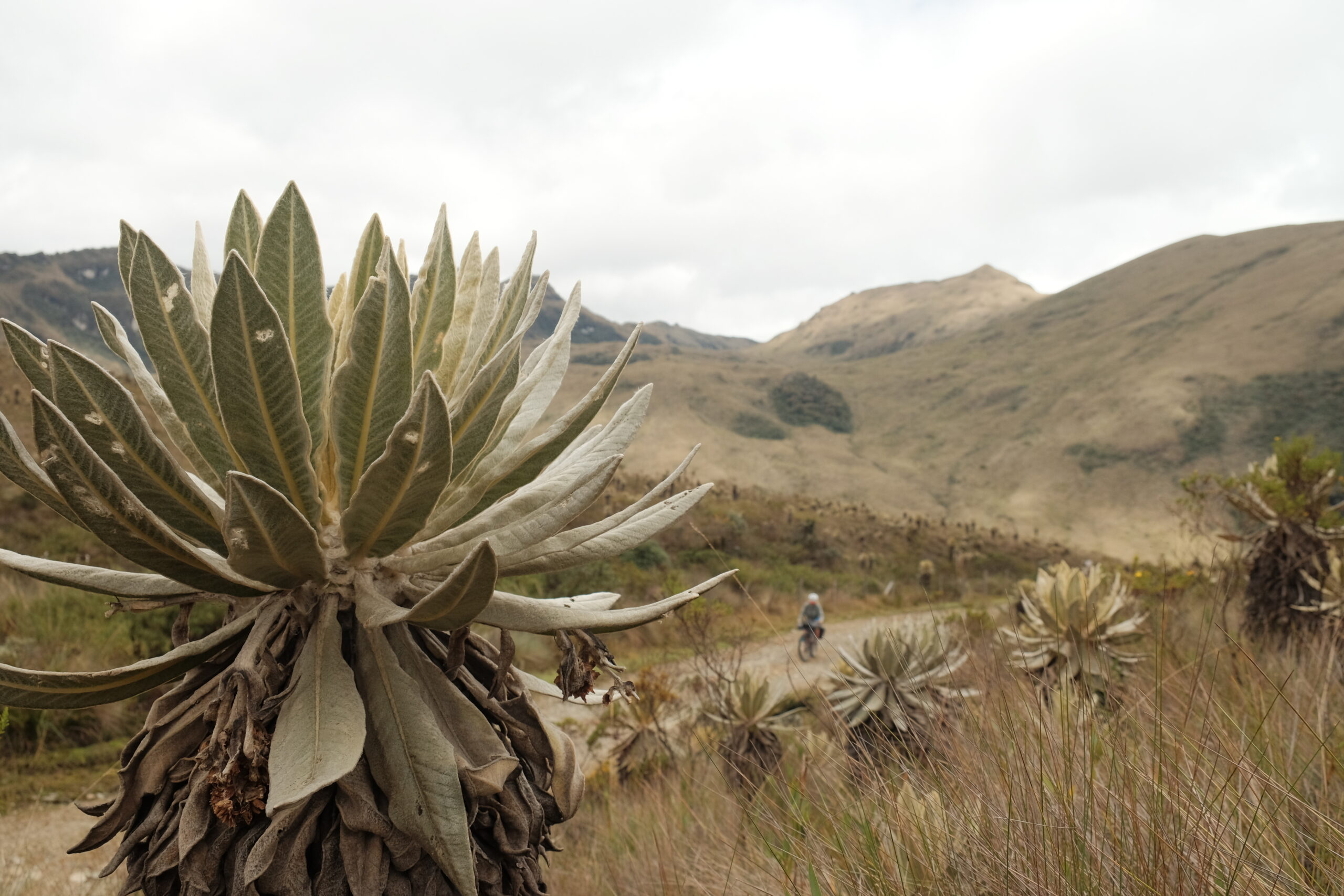
Soon, we were nudging over that magic 3500m mark and the main reason for choosing this route – the paramo!

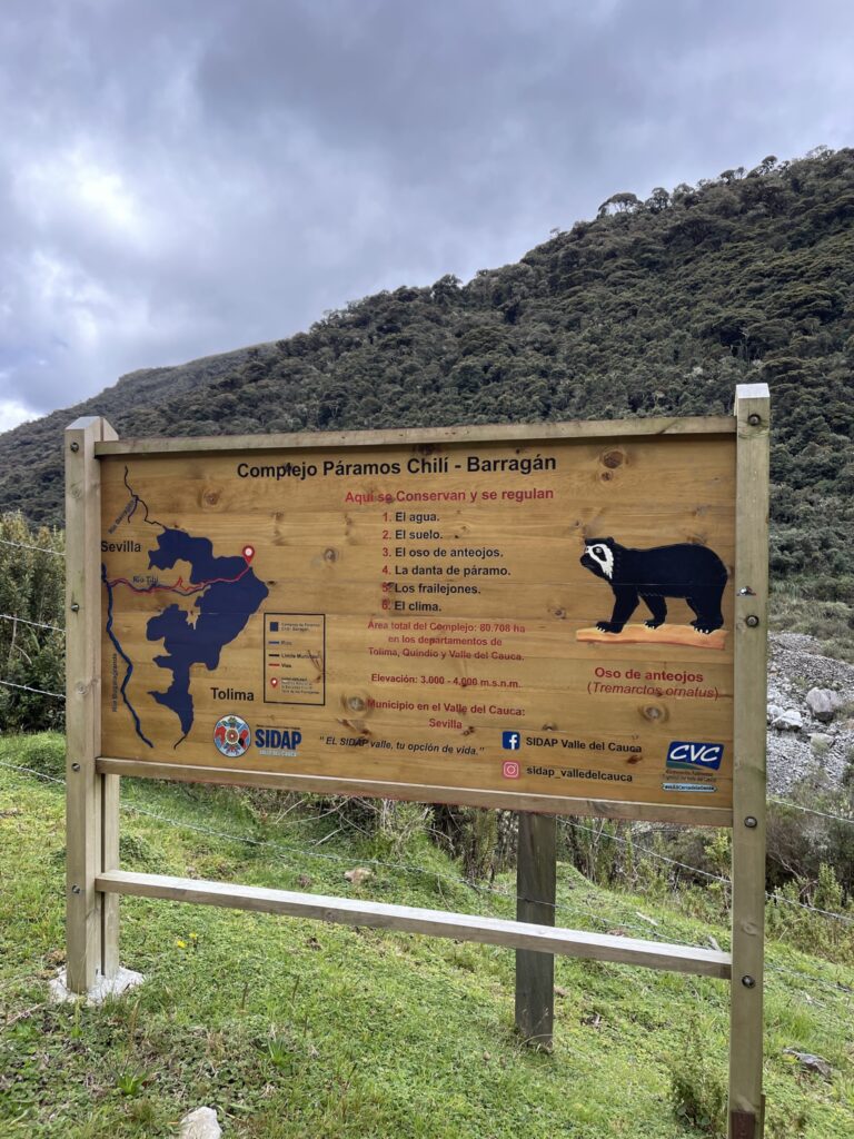
The moody clouds, the magical frailejones…the paramo has the feel of a place that time forgot. Given it’s still technically rainy season here in Colombia, we felt incredibly lucky to be able to see anything at all given it’s usually completely socked in with cloud.


From the pass, we had 20km and about 1700m of descending to do to get to Roncesvalles. The “pisos termicos” that we’d cycled through on the way up here, now winding back at about five times the speed, until we burst out into a new landscape. A wide open valley, glacial in origin we assumed on account of the shape and boulders littered around, filled with grass and cow pastures and dotted here and there with wax palms. It felt so open and bright compared to the steep, densely vegetated valleys that had been our experience in Colombia so far. Could it be paradise?


The town of Ronces itself was lovely; not visually beautiful in the way of the famous colonial towns such as Salento, although it did have a bit of that, but authentic, feeling like the frontier town that it kind of is. As the only town such a large municipality, surface area wise, it acts as the central meeting place for people miles around, a place to sell their milk and cheese (often brought down on horseback) and buy all the necessary goods for life in return.


Importantly, it felt completely devoid of touristic influence. Indeed, until 5 to 10 years ago, this area had effectively been cut off from the outside world for decades due to being a guerilla stronghold. When we cycled down the Main Street, it was obvious from people’s reactions that not many gringos had graced these concrete paving slabs, especially not many on bikes and wearing orange shirts!
After checking in to our hotel, we headed back up the way we had come in to go for a dip at a nice swimming spot we had spied just out of town. Passing through the main square, we suddenly heard a commotion behind us. An old man was running down the street yelling at us to stop! Eduardo, it turned out his name was, was something of a tourism spokesperson for the area. Over a couple of tintos (black coffee laced with panella), he gave us a potted history of the town, showing us the catalogues he’d made of some of the tourist sites – mostly wax palms with oddly shaped trunks! He asked us where we were heading next, so we gave the names of the next few towns we sort of planned to stop at. Before we knew it, he was scrolling through the contacts on his phone.
“I went to a tourism conference a few months ago, and met someone in town X. I’ll give you his number. In fact, I’ll call him up right now and tell him you’re coming!”
And so it was that our itinerary for the next few days was planned out for us whilst standing in the middle of the road by the main square. I often feel very awkward when recommended specific people to contact or hotels to stay in, since my Spanish isn’t good enough to determine exactly what I’m committing to and how much it will cost (tight arse that I am)! However, as the next few days went to prove, sometimes you just have to lean in and go with the flow! But more on that in a future blog post.
We left Ronces the following day, not without some regret and not spending more time in this beautiful valley, en route for San Antonio. The first 10km followed the Ronces theme of dairy pastures dotted with wax palms, then we turned a corner and…
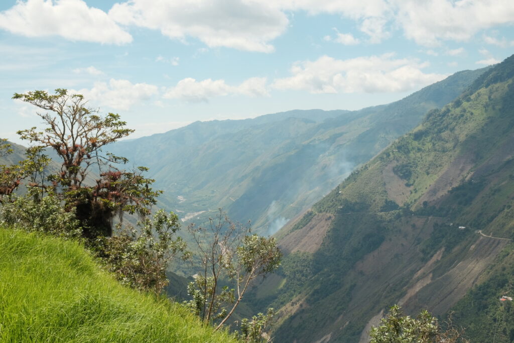


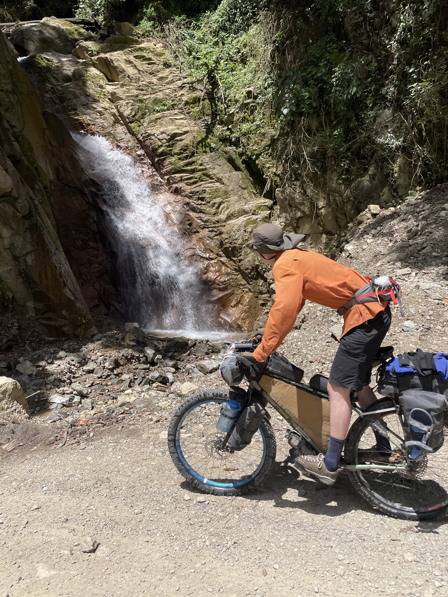


By the valley bottom, the temperatures were back to being properly hot again, so we had a quick water and snack break before tackling the short (relatively) 400m up and over into San Antonio. This proved fairly uneventful apart from me getting bitten on the leg by a dog. Luckily it didn’t draw blood, so no further action required. If there is one thing against Colombia as a cycling destination, it is the dogs. The stray ones are often friendly as they just want some food – it’s the guard dogs you have to be wary of. Each finca has at least 3, and you’ll often go past a new finca every few hundred metres, meaning getting chased by barking dogs at least once every 10 minutes. Often they just bark and nothing more, but you’re never 100% sure and it does gradually wear out ones nerves.


After completing the daily ritual of an Almuerzo in San Antonio, we hooked up with Juan Carlos, the first of Eduardo’s contacts from that tourism conference! He accompanied us on his moto 200m back up the hill (not what the legs needed) to Villa Laura – the small eco-lodge he lives in a runs with his partner. When they bought the place 7 years ago, it was nothing but pasture, but they have since completely transformed it, and a lot of the adjacent area, into an oasis for wildlife. Plants grow fast here, in the UK this would have taken decades!


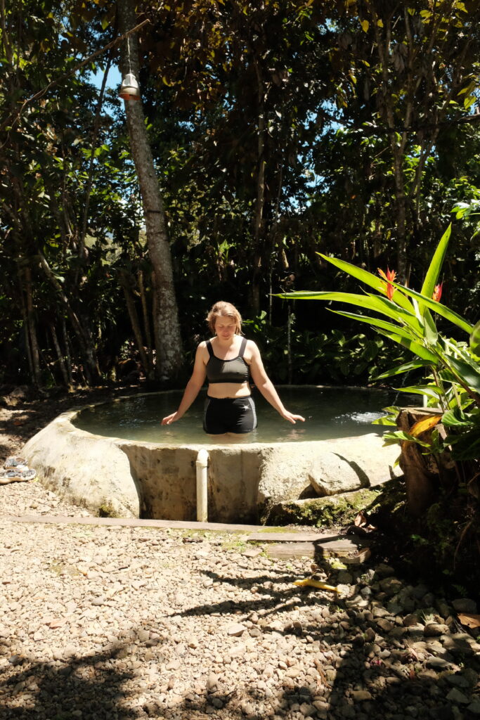


That evening, Juan took us up the hill in order to get a night time view over the town and the surrounding hills. This is an area that resisted Spanish occupation, long after most of the rest of Colombia had been colonised, due to its surrounding mountains which made it easier for the indigenous people to defend. Despite this, they were also eventually massacred and their bodies dumped in mass graves in the hills. More recently, the FARC used the same geology to their advantage and the town was a significant stronghold for the group. Juan spoke of how, as a young man, he and thousands of others were forced off these lands due to the conflict. It is only post the ratification of the peace treaty with the FARC in 2016 that people have started to come back to the area. The rate of return increased significantly during COVID, as many people, not just displaced locals, sought out the countryside and the space it provided. With the security of the region now stable, at least in the area around San Antonio, a nascent tourism industry is starting to grow, of which Juan is a major instigator. It felt really rewarding to play a small (tiny) part in helping the redevelopment of this area as it opens its arms to outsiders once again, in a sustainable way that benefits nature as well as the people that live there. Hopefully, on reading this, you’ll be tempted to visit too! You won’t regret it!
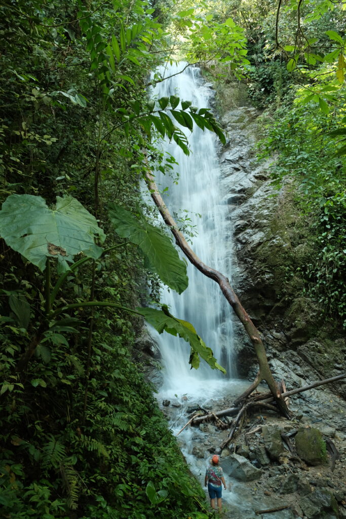
The following morning, we headed out with Juan to visit a waterfall on the river that provides the water for his finca. We set off up the road and after a few hundred metres, ducked through the barbed wire of his parents’ farm and into a small nature reserve they have created.


Up through coffee plantations, past a tiny school, down some switchbacks, then we were there. I had expected waist, or at most, head high, but this thing was actually pretty big!
Post walk, Juan accompanied us into town for “the best bread in town” (freshly baked, mmm), “the best ice cream in town” (coconut mini milk, mmm) and some obligatory selfies in front of the church. It was gone 1pm at this point, so with regret, we extracted ourselves from Juan’s abundant generosity and headed down into el infierno (his words). But that is a story for another post I’m sure you’ll be glad to hear!
Muchas gracias por visitar nuestro territorio, fue muy agradable hacer parte de su historia de viaje y también ya hacen parte de nuestra historia del lugar.