Whenever we’ve discussed hike a biking ourselves through the Huayhuash with new friends we’ve made on the road, a comparison is usually made with Ausangate; another hiking loop popular with foreign tourists that has attracted the attention of cycle tourists who are quite content to push their bikes, if you promise them a good view. Peru’s fifth highest mountain is known by the locals as “the father of all mountains” and was of spiritual significance to the Inca who believed it to be the brother of Salkantay mountain. Among cycle travellers, Ausangate is regarded as the less extreme, more enjoyable and more rideable cousin to the Huayhuash.
We were excited to be back out on two wheels and pedalling towards the big mountains, however, our bodies had become unconditioned after nearly 3 weeks off the bikes. We took two days to ride to the start of the loop in Chilca and, as the soreness in our bottoms grew, we were soon longing to be out of the saddle and pushing our bikes. The ride out of Cusco gave us a taste of what it would be like to tour South America on tarmac roads, busier and less scenic, but with so many options for lunches and roadside snacks! On day 2 we had lunch in Pitumarca, at a makeshift cafe set up by a couple of Quechuan ladies in the square, before turning off the tarmac and climbing a smooth dirt road towards the bright white peak of Ausangate.

Chilca is a pleasant mountain village that seems to miss out on most of the gringo money by virtue of not being on the main hiking trail. We were welcomed by a couple of security guards, signed our names and passport numbers into the visitors book and asked about somewhere to camp. The village shop was well stocked and very reasonably priced, so we treated ourselves to a few extra snacks for the evening. Outside, the children playing football briefly paused their game to stare at us as we disappeared our food into our various bags and then headed down towards our camp spot waving goodbye. We returned to the shop the following morning to ask if we could leave a bag there for three days – Claro! – and we quickly threw some heavy and unnecessary items into Liam’s rucksack. Free from the weight of the solar panel, we were finally on our way!

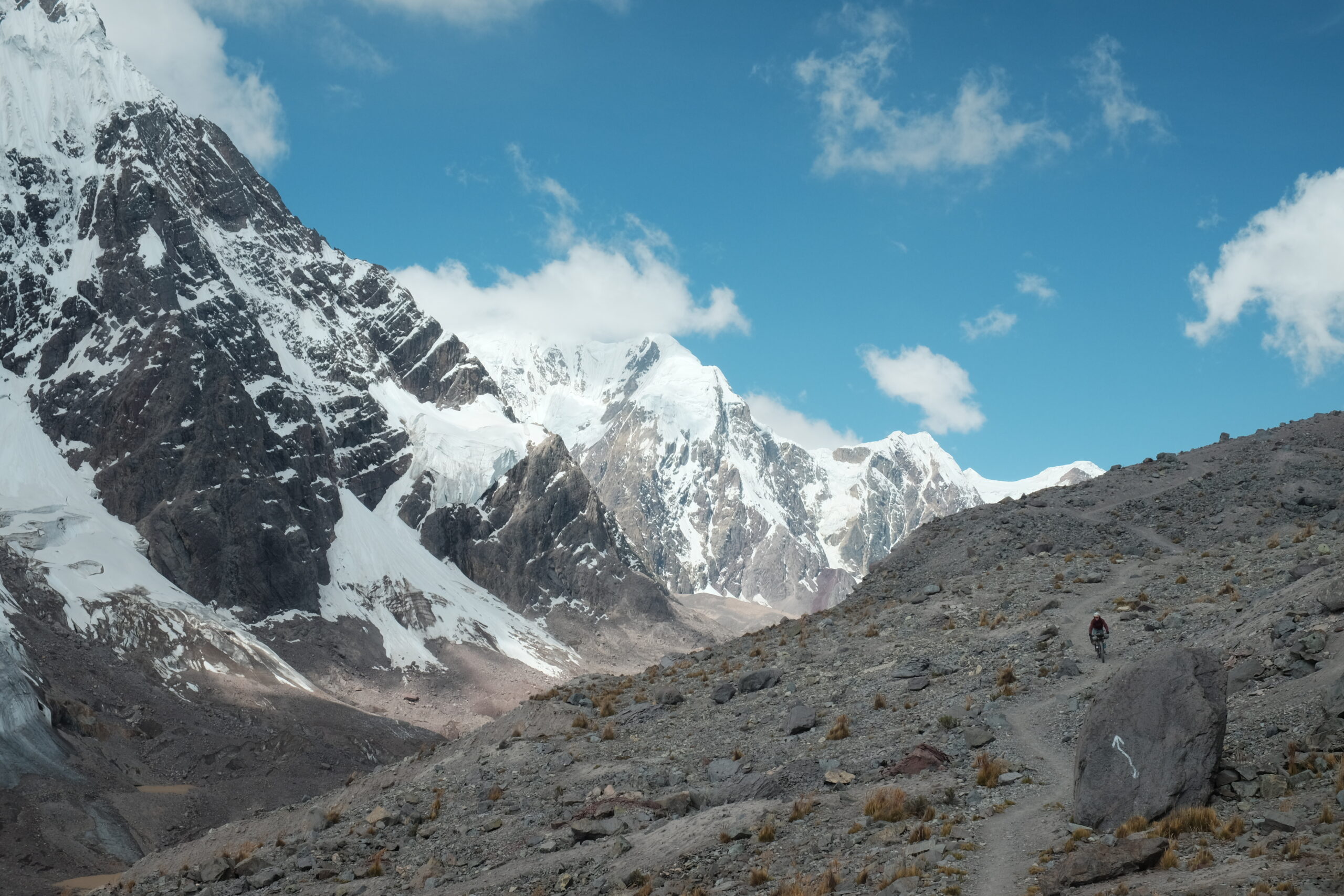
The anti-clockwise loop of Ausangate consists of three passes. Each is spectacular, surrounded by glaciers and big mountain views. Unfortunately, it wasn’t only our bottoms that had become unaccustomed and as we pushed over 5,000m on the first pass, we were gulping for oxygen as our lungs struggled in the thin mountain air. On the upside, taking it slowly meant we had lots of time for snack and photo stops.


As we approached the summit we wondered what the trail would be like on the other side. The way up had been mostly grassy animal tracks which would be rideable, but folks are quite adamant that this route is best ridden anticlockwise, so naturally, we were curious to see what all the fuss was about. We were not going to be disappointed.


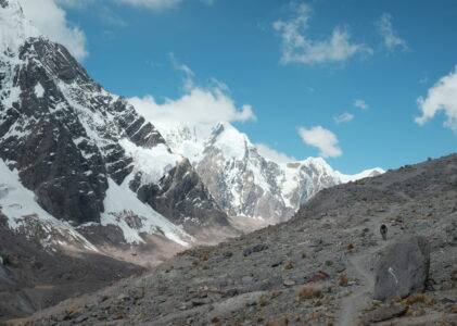
Elated and euphoric after the descent, we were in a state of disbelief. The trail was sometimes steep and loose but nothing we couldn’t take in our stride! This was without a doubt the best mountain biking of the trip so far! As we descended further towards some quintessentially bluer than blue glacier meltwater lakes, we were stopped in our tracks and set about finding a flat spot to pitch the tent. With the wet season arriving the afternoon weather has become increasingly unsettled and so there is added incentive to finishing early and seeking the shelter of canvas. Thankfully, after a brief rain shower, the skies cleared again and Liam got a chance to practice his night photography.


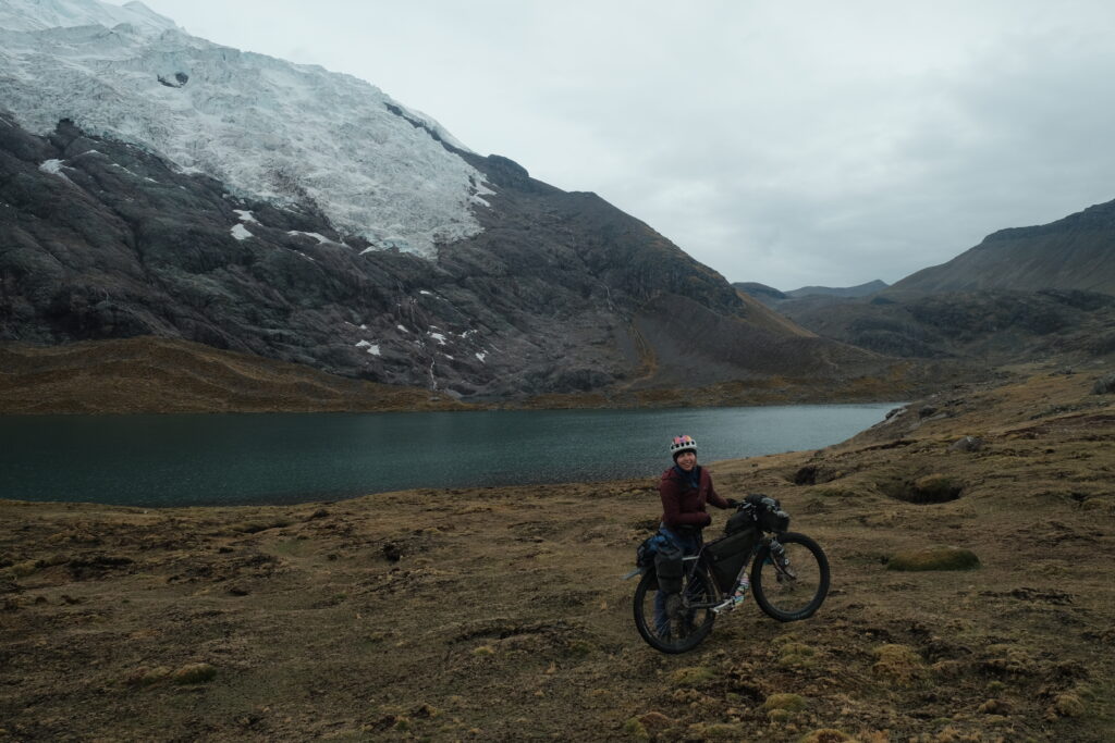
The second day arrived with perfect blue skies, another amazing day in paradise awaited us. After negotiating our way around a few more lakes we were a little off trail and searching for where our GPS devices indicated we should be. “The trail is up there” an American sounding voice called out. We turned around to see a tall, white haired man standing out the front of a choza (traditional shepherd’s hut). At first, we thought he was a hiker staying in a glamping hut, but then he retrieved a plastic box and said ‘I’ve got just the thing for you’ and picked out some foil wrapped discs. “These are cacao energy bars”. Tatanka was a hermit who had been living in this choza for a few years, renting the building off the local family. He shared that he was nearly at the point of being accepted by the local community, how teaching the children English was helping, but that initially people had been very suspicious of him. He gave us a tour of his tiny home which consisted of a bed and sofa which he had built himself, a small cooking area with hanging utensils, a wood fired stove (which only gets lit when he has visitors because lugging logs up the mountain is hard work), a water filter and solar power. Both intrigued by the idea of living simple, off grid lives, we were avidly taking mental notes. Touched by this random encounter and excited that our pockets were net calorie positive, we started the next push.


After a short push we descended towards the only settlement on route, the small town of Upis which is usually a stop for hikers. Here we paid a fee to the community for passing through, crossed the river and quickly started going uphill again, this time under the watchful gaze of Ausangate’s rocky North Face. Being in the Southern Hemisphere the South Face is covered in much more snow and the North Face is the one which bears the brunt of the sun. We also bore the brunt of the late morning sun as we sweated towards the top of the pass, but once again our efforts were not in vain.


We stopped for lunch and by the time we had reached the bottom, ominous clouds had started to gather and the air was notably cooler. At this point we had a dilemma, cross a raging river and scramble with our bikes over some large boulders to follow the GPS track, or follow what seemed to be the main hiking path which stayed lower, hugging a series of lakes before rejoining the track. Given the turn in the weather we opted for the latter, lower option and donned our raincoats and recommenced pushing. It didn’t take long for the trail to disappear under rockfall and we were carrying our bikes fearful of scraping wheels or bashing our rear mechs.

The pushing and the precipitation got worse until we reached a rocky impasse. With a big, wet, slick rocky scramble standing between us and the trail, and with the rain getting heavier, we backtracked to the nearest patch of flat ground and pitched the tent outer. We clambered under the fly just in time for the rain to turn to hail and sat there for about an hour as the hail got heavier and the stones got bigger. We regretted our route decision, but were glad we weren’t higher up. We decided to take another look at the scramble in the morning and if it was still impassable in the dry, we would backtrack and follow the original route.

On his morning sunrise trot Liam assessed the rocky crux and thought our chances were good. So before our porridge was on the stove we removed any remaining bike bags and carried our bikes through. Once the bikes were sat safely in the next cove around the lake, we sat down for breakfast happy in the knowledge that we weren’t going to have to backtrack.
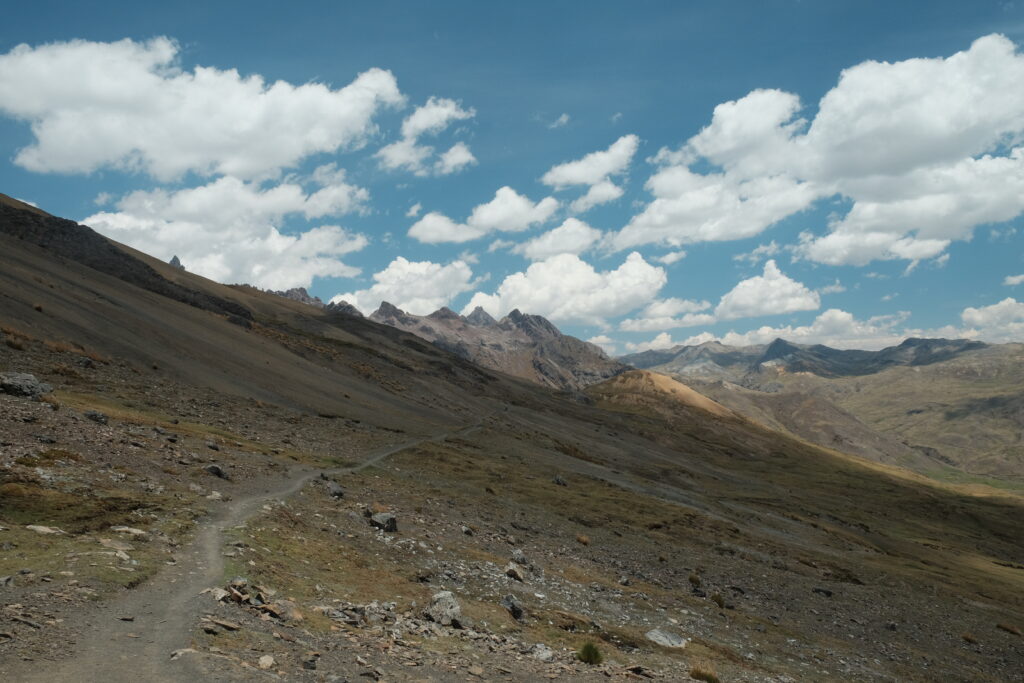
The third and final pass of Abra Apuchata was accompanied by a heavy layer of cloud. Not overheating made the pushing easier and we enjoyed the moody, atmospheric skies. As I pushed up, I looked down to see a Quechuan woman in full traditional dress sheltering behind a stone wall has she watched over her flock of alpacas. The humour isn’t lost on me that we obsess over the right technical clothing for these high alpine environments and the hardy locals are fine with a few kilograms of wool! We also passed a pair of hikers who we’d seen on the first day “Why do you want to make your holiday hard for yourselves?!” one of them called out. “The time passes more slowly if you’re not having fun, we want to savour our trip” I shouted back in jest.


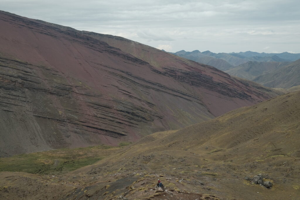


The final descent was steeper and more technical, as we got our elbows out and body weight back to negotiate the tight corners, the famous red substrate of the Valle Rojo came into view. It is possible to extend this ride into the red valley and visit Rainbow Mountain, but we’d decided to give this a miss. Given the amazing experience we’d had having the mountains practically to ourselves, we were happy to give these tourist hotspots a miss and linger on the fantastic experience circumnavigating the father of all mountains.

Routes
If you’re interested in our routes, you can find them all on our trip homepage.
Pingback: Ruta de la Tres Cordilleras (light): Chilca to La Paz - drawinglinesonmaps.com