It would be fair to say that I’ve spent a good number of years dreaming about climbing this mountain. Ever since reading about Neil and Harriet’s incredible Puna 9 trip, it’s been in the back of my mind and started to loom ever larger as we crossed into Bolivia and were only a small country away.
The Prep
Since Cusco, I’d been trying to get out for short runs every morning before breakfast, trying to condition the legs to uphill hiking and downhill running after many months of pedalling. I managed to get up to 5600m on Volcan Sajama; not quite as high as I would have liked, but a good first proper altitude experience. Next on the training hit list was Volcan Tunupa on the edge of the Salar de Uyuni. At 5150m, it’s not the highest, but the 1500m elevation difference from the base and the fact that it’s a 24km round trip from Tahua meant that it was still a great test of the legs.
(As an aside, this was, by far, the longest run I’ve done since the Highland Trail 550 in 2021, after which I mysteriously stopped being able to run further than a mile for the best part of the year. I’ll get round at some point to writing up a separate blog post about my running issues and how they miraculously resolved themselves on this trip).
The final stage of my training/acclimatisation was planned to be two 6000m peaks in Southern Bolivia. However, neither of these was meant to be. The first, Uturuncu, which we’d planned to do together, we had to miss due to El’s illness and not quite being on the schedule we needed to be on and the second, Licancabur (okay, not quite 6000m, but close), I had to skip because there was a big snowfall the night before!
Due to missing out on these important milestones, I really wasn’t sure how my body would react. The summit of Llullaillaco was over 1000m higher than I’d ever gone before, which is a lot! Especially given that I wasn’t planning on multiple camps on the mountain itself – I’d be climbing it in a oner from basecamp. It was a case of go big of go home. Success was far from certain in my mind.
The Plan
Trying to summit a 6000m+ mountain in the middle of an already isolated, committing route such as Seis Miles Norte, is no small feat logistically. Spending multiple days on the hill requires a huge amount of extra food and water, which is tough when you’re already carrying 18 days’ worth of food and 3 days of water just for the cycling. Given this, and the fact that I was riding with El and Annie, who wouldn’t been too keen on hanging around basecamp twiddling their thumbs while I went off on a jolly, I decided that any attempt on this summit would have to be squeezed into the overall Seis Miles schedule without adding any days.
So, here was the plan: I’d split off from El and Annie when they dropped down to Salar Llullaillaco and head up to basecamp. The following day, I’d climb and descend the mountain, before getting back on the bike and riding the 70km or so to Mina Casualidad, where I would meet back up with them. Ambitious, to say the least.
The Story
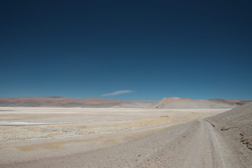
I said goodbye to El and Annie at the giant construction site that is now Salar Llullaillaco. They would be getting a lift through the site to the southern exit, whereas I needed to be escorted to the West, across the salar itself. Loading the bikes into the company pickups was a time consuming faff and not without incident – one of the security guards stupidly tried lifting my bike out of the pickup, didn’t realise how heavy it was and promptly dropped it, breaking the bottle cage I’d been using to attach our fuel bottle to the rear of my rack. Oh well, no use in getting angry about it. They must have felt a little bit sorry, even if they didn’t actually apologise, because I got given 3 oranges, a bunch of biscuits and chocolate bars and a whole litre of orange juice. The extra calories were gratefully received as I was only too aware that I would be asking a lot of my body in the coming days.
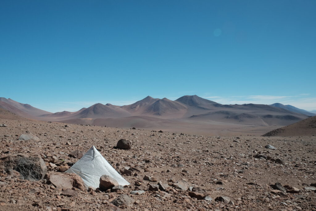
The whole rigmarole at the mine had delayed me by over an hour, so it was with a renewed sense of urgency that I started pedalling again around the Western edge of salar if I wanted to beat the afternoon winds. At the same time, I needed to save as much energy as possible for the following day – a difficult balance to achieve. The climb up from the salar was frustratingly sandy and possibly the first glimpse of what awaited us on the Seis Miles route, once we escaped the main mining area with it’s well transited roads. I peeled off the climb up to Llullaillaco pass at around 4400m, stashed my bike (it was getting too soft to be worth the effort), transferred the kit I needed into my big rucksack, and hiked 8km to the basecamp (4900m) for the North-East route. This was the route I had the most info for, including a gpx track. I arrived at around 5pm and set about trying to find a bit of shelter to pitch the Hyperlite Gear Mid 1 that Annie has very helpfully lent me. I found a small makeshift rock wall that had just enough flat space behind it for the tent. It wasn’t great, but it would have to do. I set my alarm for 3am (oof) and got an early night.
Sleep was difficult that night; whether due to the altitude, the anticipation, or the wind flapping the tent into my face, I don’t know. When my 3am alarm went off, I’d already been awake for a few minutes. I’d slept in the base layers I’d be using for the climb, so I simply chucked my outer layers on and headed out. It was very cold, but just about manageable given the effort level I was putting in. There was a good tread to follow for the entire first section of the route – the few times I lost it in the dark, a quick glance at my gps got me back on track again. At 5900m there is a flat saddle that is often used as a high camp. At this point, the cold was really biting and I was slowing down a bit due to the altitude. I put my down jacket and waterproof trousers on. Now that I was wearing all my clothes, I stashed my bum bag here behind a rock and continued on with only my running vest with my biscuits, water and camera in it.
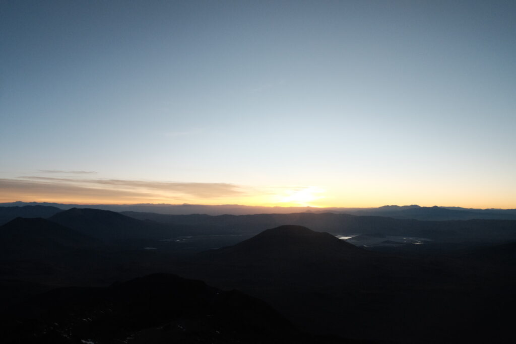
The following section up to the next saddle at 6500m is the crux of the route. The going gets much steeper and looser, route finding gets more difficult and the altitude really begins to make itself felt. I’d been half expecting to feel the onset of altitude sickness at some point, but it seemed like my body was cooperating, so I kept on going. I was just very slow – my goal of maintaining a >500m/hr ascent rate slowly slipped out of reach on this section. Coming over a small arête, I spotted another group of people climbing up this gulley, but further to the south. They were fully kitted out in Himalayan climbing suits with crampons and ice axes, but were moving even slower than me (didn’t think that was possible). I’d hoped to be very near the summit at sunrise, but had to content myself with watching it from this gully instead. The first rays to hit me immediately warmed my bones. This was much welcome as it was so cold, but I knew it also meant that my schedule was slipping.
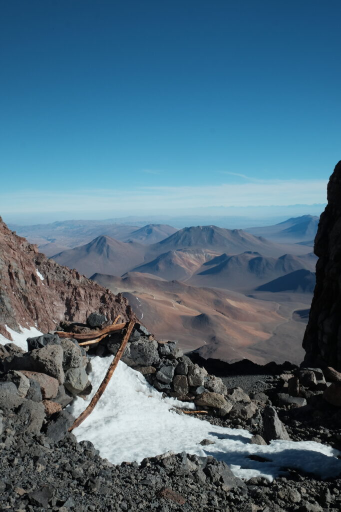
From this point, I found a few snow patches that were soft enough to kick steps into, offering a quicker ascent option than the loose scree I’d been battling with. A few times, the snow would randomly get rock hard and I’d have to down climb to find another way up. Finally, FINALLY, I topped out of the gully at 6500m, where there are some Incan ruins. Despite being over 500 years old, the wood is still amazingly well preserved due to the weather conditions up here.
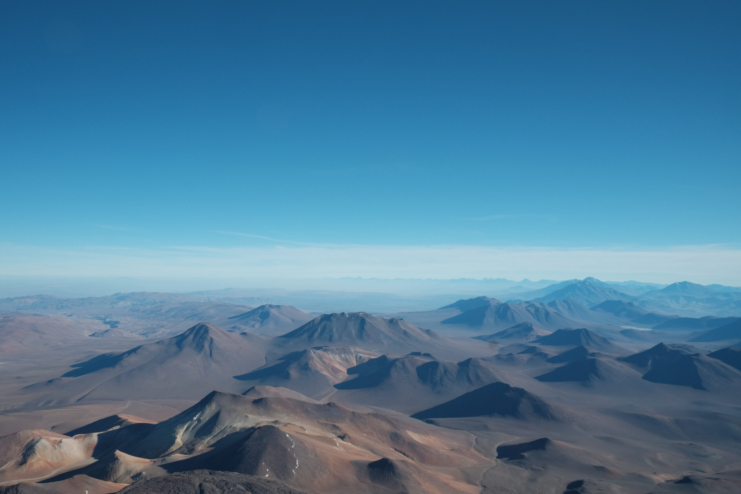
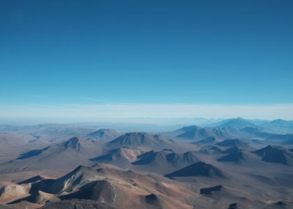
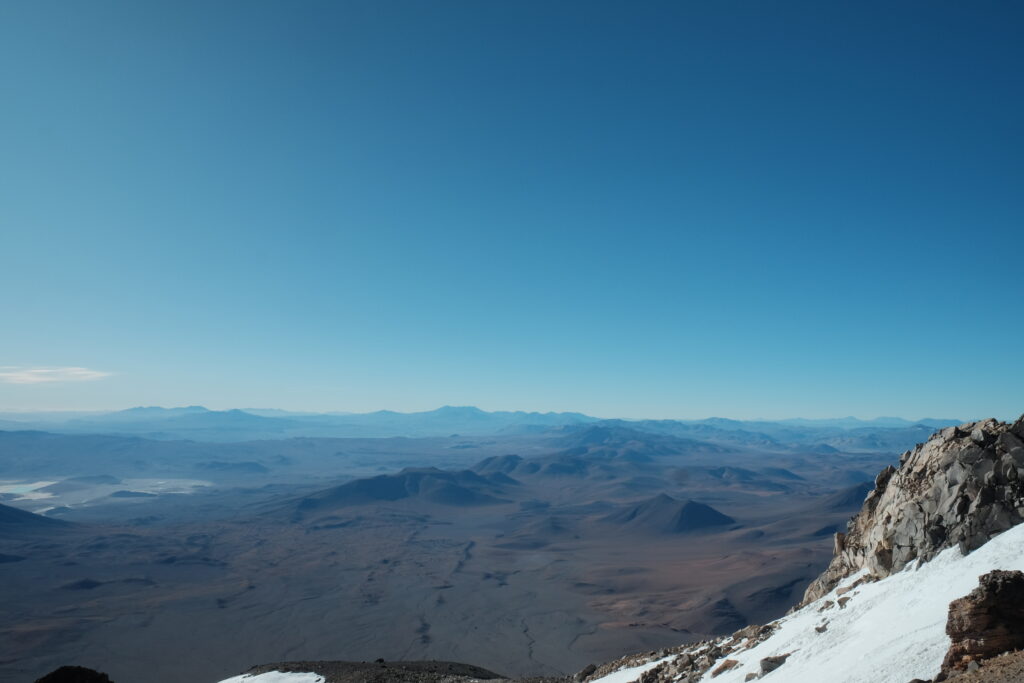
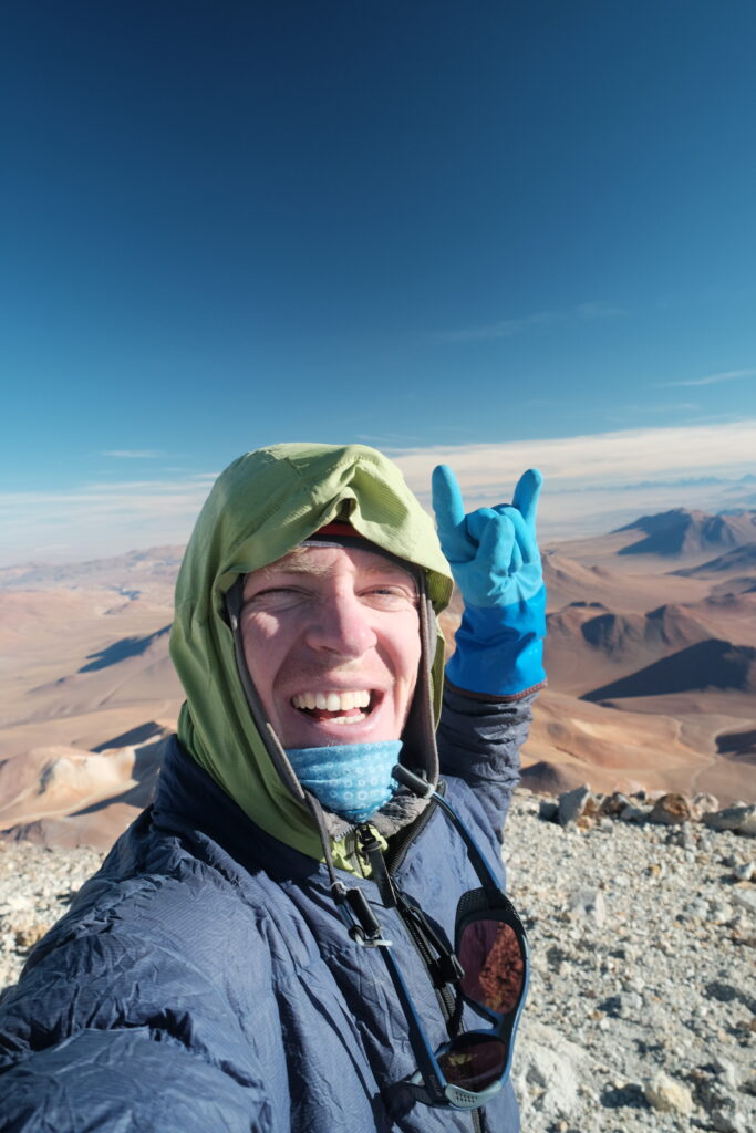
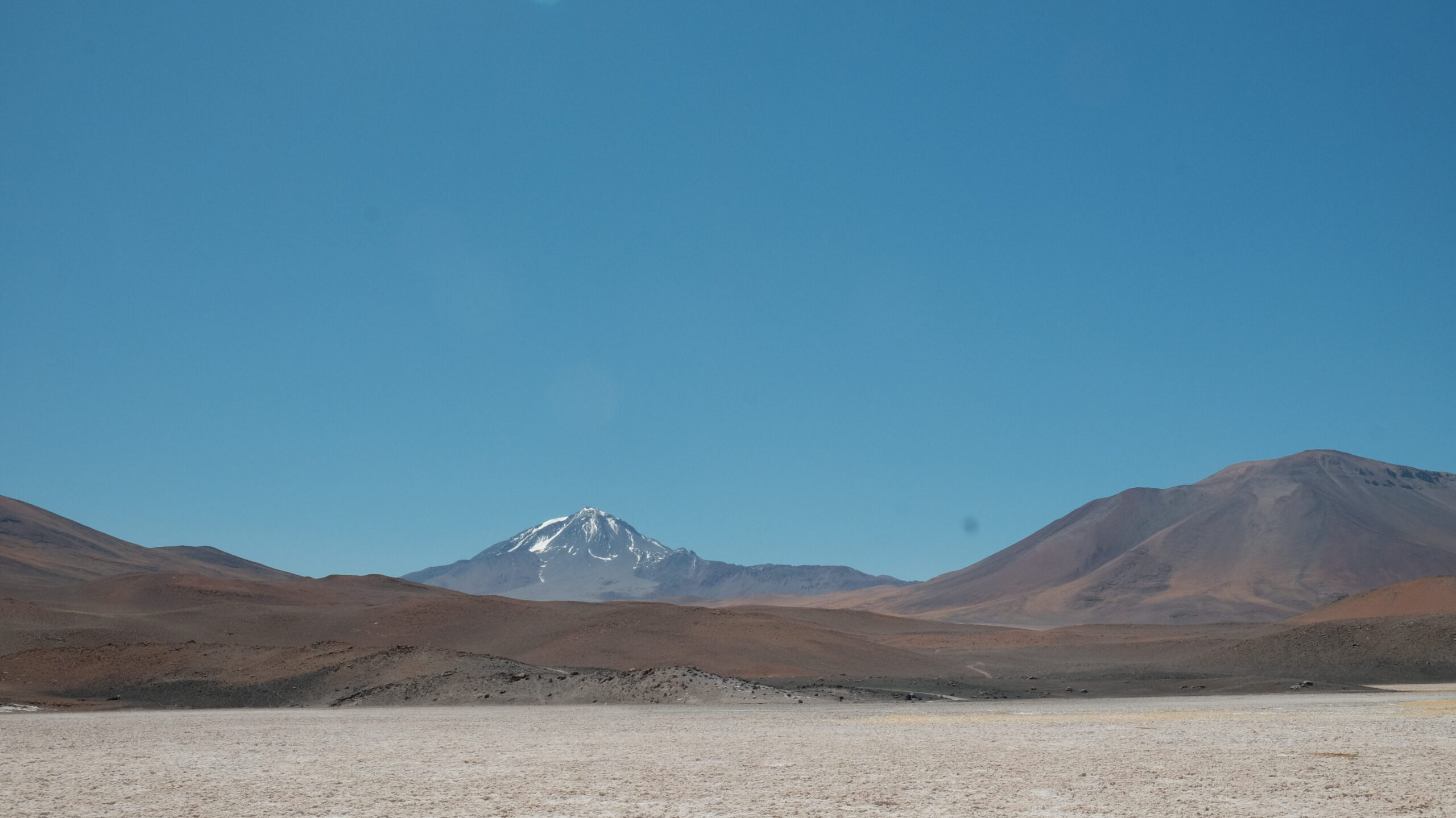
At this point, it was 8am – the turnaround time I’d set myself at the outset. However, I could see that the summit was an “easy” 200m walk further up and I knew that I’d never forgive myself if I turned around now. I wasn’t coming back anytime soon and would just have to make the time up on the bike. Those final metres were real slow, despite being technically a lot easier. Managing 10 consecutive steps without stopping to catch my breath counted as a success, but by 8:15am there I was standing on top of the world with no one else around. It had taken nearly 5 hours to get here from basecamp. What had initially attracted me to Llullaillaco, in addition to it being very accessible from the Seis Miles route (though not very accessible from anywhere else!), was the fact that it stands so proud from all the other mountains around it. There is nothing anywhere close to the same height within view. There I was, feeling like I was on the edge of space, looking down at the world beneath me. Tears might have been shed.

After giving myself a generous 5 minutes to soak it all in, I started heading back down. Time was a’ticking after all and there was still a hell of a long way to go before I could down tools this evening! The first section back down to the Inca ruins was nice and easy. At this point, I took an alternative route down to the North that I’d read about on SummitPost. This was both steeper and looser (if that’s even possible) than the ascent route, but going downhill and being prepared to spend a significant portion of the time sliding down on my ass, it was a much more direct and efficient way of descending. Back at the 5900m saddle, I picked up my bum bag, then descended the final 1000m back to basecamp, arriving around 2 hours after leaving the summit. My total time from basecamp —> summit —> basecamp was around 7 hours.
At basecamp, I packed the tent and all the kit I hadn’t taken with me on the climb, then started the 8km hike back down to my bike. This seemed to take quite a lot longer than I remembered from the way in! Back at the bike, the second round of faffing began as I transferred all my kit from my rucksack back onto my bike. After a quick sandwich and cold brew instant coffee (about as tasty as it sounds), I was off riding at 1pm. I had about 7 hours of daylight left to ride the 70km to Mina Casualidad. Game on. Hopefully El wouldn’t get too worried about me as the daylight faded as we hadn’t actually discussed what we would do if I didn’t manage to make it that day!
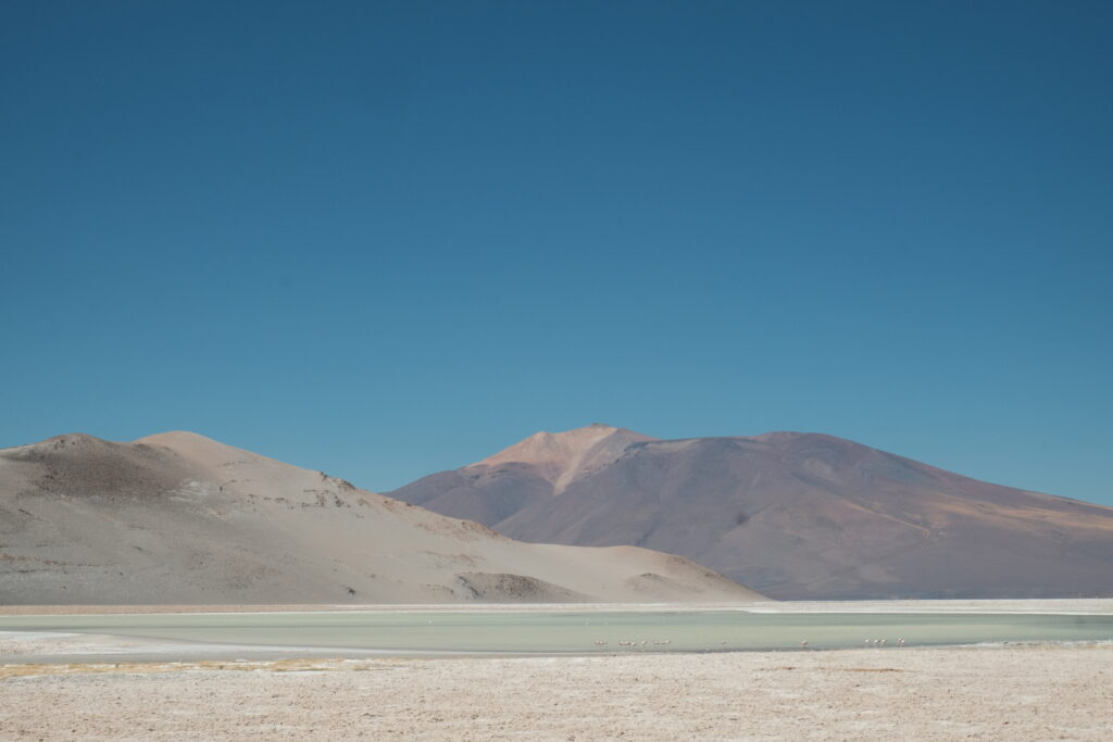
The sandy drop back down to the salar was mercifully much easier than on the way in and I was soon riding along a 4×4 track in what felt like searing heat. What a contrast to this morning! I was at this point over 3000m below the summit, so I guess it shouldn’t have been a big surprise.
The wind at this point was picking up, but it was a cross/tailwind, so generally helped me make good time. This side of salar was completely empty of vehicles, in contrast to the building site on the other side.
Reaching the Southern end of the salar I rejoined the road that El and Annie would have taken yesterday. A 700-ish metre climb was all the stood between me and the descent to Mina Casualidad. I could do this. The steeper lower sections were relatively sheltered from the wind and therefore passed quickly – it was the long, false flat uphill over the wide pass that really dragged on as the wind became more of a head/crosswind.
I could see the top long before I reached it, sitting off in the distance tantalisingly close, but never seeming to arrive. This seems to be a feature of Puna riding – because there are so few foreground objects to measure one’s speed against, progress feels terribly slow. Eventually though, I made it over the top and flew down the super fast descent to La Casualidad, where I found El and Annie in the abandoned church just starting to wonder where I was.
I arrived at 7:30pm, making it 6.5 hours of bike time. The total stats for the day were:
- 16hr30 total time, just under 100km total distance
- 7hr, 18km climbing and descending Llullaillaco from basecamp
- 1hr45, 8km walking back to the bike
- 6hr30, 70km riding to Mina Casualidad
- 1hr15 stopped time, mostly spent unpacking basecamp and re-packing my bike
That was by far the biggest day I’ve done in quite a while. Given that, apart from a couple of sandwich rolls at lunch, all that I’d eaten to fuel this effort were a couple of packets of Oreos and a few handfuls of trail mix, I knew the following few days on Seis Miles would be tough due to much depleted glycogen levels. I wasn’t wrong! Seeing how my body reacts under stress is one of the reasons I like doing these challenges, though; I was just as curious over how my body (and mind) would handle 10+ days of restricted calories after such an effort, as I was about how I would cope with the altitude. Plus, as El always likes to point out to me whenever I complain, I’ve only got myself to blame!
Useful info
- Basecamp for the North East route is at 24.69936°S, 68.48750°W
- There is a well defined 4×4 track heading up to basecamp from the main track to Llullaillaco pass. The turnoff is at 24.73563°S, 68.41945°W. Although well defined, it was pretty soft so I decided it would be faster to walk than try to ride
- From basecamp, there is a obvious tread that is pretty easy to follow all the way to the summit
- I had Hans de Neve’s gpx track on my gps for piece of mind and to help me back onto the path whenever I strayed off it (easy to do in the dark)
- I used the descent route described on SummitPost to get from the saddle at 6500m to the one at 5900m. This was definitely faster and more efficient than trying to reverse the ascent route. Just be sure you’re comfortable surfing down steep scree!
- I didn’t need any ice equipment such as crampons and ice axes for the ascent. Although there was some snow, most of it had helpful pockets that I used as foot and handholds, or was soft enough to kick steps into. I definitely benefitted from having some big lugs on my Saucony Peregrine 12 ST shoes which helped in the snow and more generally on the steep scree.
- In terms of clothing, I had just enough to stay the right safe side of cold as long as I was working hard. I wore a LS merino blend mid-weight shirt, a hoodie, a wind jacket and a PHD Minimus down jacket on top. For bottoms, I wore my riding trousers and waterproof over trousers. The blue gloves are the excellent Showa Temres 282 gloves which have kept my hands happy in bad conditions a few times now. A big pair of mitts would have made things more comfortable, but you gotta run what you brung. My feet were probably the coldest pair in just a normal pair of hiking socks and the trainers.
Through a bit of wilful misreading, I had an image of Liam clad in just a “running vest” jogging up to the summit while the Himalayan-clad climbers slowly trudged in his wake. Boy’s Own adventure! Fantastic achievement, well done.
Well worth the effort – congratulations. A great read too.
Blooming heck, what a treck! Glad you enjoyed it!
Well done!