
The Puna region of northern Chile and Argentina is dry, remote, windy, barren and largely uninhabited. According to folklore, it is where 70% of the world’s unrideable roads are found, all thanks to deep sand, volcanic dust and fierce headwinds. Sounds like a lovely place to go for a bike ride doesn’t it? There is likely to be a brief window in time where bike tourers can enjoy crossing this landscape in solitude. That is because bicycles capable of crossing this barren landscape are only a relatively recent invention, while the region is rapidly attracting lithium miners and prospectors that threaten to permanently change the “feel” of the route (if not the actual route itself).
The Ruta de los Seis Miles or route of the six thousanders (in reference to the chain of 6,000m volcanoes along this region) is considered by many to be the queen stage of any off-road South American tour. It is a route that made us both excited and nervous in equal measures. When you see South American bike tourists strapping additional bottles of water to their bikes and loading up with over two weeks worth of food, it usually means one thing… they’re crazy.
The elevation profile for the route shows that you rarely dip below 4,000m, combined with the requirement to plan, carry and manage both food and water in this arid environment, it really felt like this was the culmination of all the touring craft we’d honed over the last 7-8 months. Thankfully, because of the efforts of others exploring and documenting this region, setting off into the Puna on bikes it isn’t quite as risky as my introduction sets out. This route was first put together by Taneli Roininen for bikepacking.com and is quite possibly the most annotated route I’ve ever seen on RideWithGPS. Every camp spot and water source indicated by helpful POIs (points of interest) giving their exact location and helpful notes as to how to find them. Camp spots are the trickiest, as the afternoon and evening wind can be strong (and sandy), so finding a wall, abandoned building or even just a mound of earth to camp behind can make all the difference. Gone are the days of the Peru Divide where any flat spot would do!
We also relied heavily on Mark Watson and Hanah Black’s write up on the highlux blog, and I’ve decided to follow the same structure with our own write up. By giving a day by day breakdown we hope that our account will be helpful to others attempting this route. The blog is split into two parts because I wrote too much and Liam took too many photos. But perhaps that’s no bad thing. I also think this represents the two halves of the ride, the first stretch to Mina La Casualidad which was busy with miner trucks and generally on good (if sometimes loose or washboarded) tracks and the much more isolated second half which was the empty, breathtaking and sandy Puna we’d envisaged.
Day 1, 90km, San Pedro De Atacama to Laguna Quisquiro
After meeting up with our friend Annie Le and thoroughly recovering stomach health, energy and resilience levels in San Pedro De Atacama, we set our sights on departing on Wednesday 15th November. The original Seis Miles Norte route took a mountain pass with a border post (Paso Socompa) which is no longer open to tourists, the alternative (Paso Sico) is also closed to anything but trucks and trains. The remaining pass over Passo Jama is a bit of a detour and also requires climbing 2,000m straight up from San Pedro, which none of us were that keen on. Marcello from Atacama Cycles came to our rescue and for a princely sum of 60,000 Chilean pesos will ferry up to 3 cyclists up to Hito Cajon, where we’d crossed from Bolivia in a snow blizzard only a few days earlier.
Getting out of Marcello’s pickup it was quite possibly colder than it had been in the snow! An icy cold wind was blowing fiercely, which was unusual given it was so early in the morning. Normally the wind doesn’t pick up until the afternoon. We hurriedly pulled on layers and re-attached our bags onto our bicycles and pedalled along the tarmac. Despite the sun eventually coming out, it didn’t warm up and I used a wee stop to pull on an extra pair of socks. It was freezing! As we rode along, a salty stream had frozen solid and birds were opting to stick to the ground instead of take their chances in the air.
Before setting off we had made a rough daily plan, knowing that while it would probably fall apart somewhere along the way, it was helpful for us to plan out how many days’ of food we thought we needed and where our big water carries were. As they say, no plan survives contact with reality and ours was no different. Despite methodically preparing for the altitude with practice rides, Annie was finding the elevation a bit of a struggle and unfortunately, on the climb over 4,800m which took a lot longer than it should have thanks to a gusty headwind, Annie went from breathless to quite unwell. Concerned about her health far more than her bicycle, we flagged down whatever vehicle we could and sent her back down to San Pedro, hiding her bike behind a sand dune. We would worry about how to collect it later.
Liam and I carried on over the climb and descended into a strong cross/tail wind. I felt very unsafe riding in these conditions and dismounted to just try and push my bike along. Liam, concerned that we would not reach any kind of hard shelter from the wind that night if we carried on at this pace taught me how to ‘surf’ the wind. He demonstrated that by sticking out my right leg, to act as a counter balance, and hovering over the nose of the saddle, to put more weight on my front wheel, I could use the wind to my advantage. At one point I was being pushed up a 5% incline at 41kph with no pedalling!
Exhausted and worn down by the constant roaring of the cold wind in our ears, we finally reached our intended campspot at a mirador overlooking a dried up lake. Despite a solid wall for shelter the wind was swirling around and we really feared for our tent. It was not the most restful night!
Day 2, 30km, Laguna Quisquiro to Jama
Thankfully, the wind did die down during the night and we were tucking into our porridge and coffee as the first tourist bus rolled in to the mirador. After the trials and tribulations of the previous day we were grateful for an easy, rolling 30km on tarmac to the Argentinian border at Jama. After a selfie with the welcome to Argentina sign, and navigating the bingo card and numbered window challenge that was border control, our priority was to find WiFi to get in contact with Annie. As fate would have it, lunch and internet were found at the roadside diner.
After rehydrating and sleeping Annie was feeling much better and was on her way back up with Marcello! They’d pick up her bike along the way. She arrived at 3pm with the colour back in her cheeks and her usual smile back on her face.
We’d learned that this wind was likely part of the Zonda wind phenomenon. Other cyclists in the South American WhatsApp group were experiencing similar high winds in the region. We decided that the best plan of action was to stay put. Spending 2 nights under hard cover in Jama would allow Annie to better acclimatise and the wind was forecast to return to ‘normal’ by Friday. We checked into the petrol station motel and proceeded to eat through the day’s rationed ride snacks before the diner re-opened for dinner at 7.

Day 3, 0km, Jama to Jama
The winds were close to 100kph and we were very glad that we’d opted to stay in the most structurally secure looking building in town. Annie hadn’t got sick and Liam and I ate all our biscuits. We played monopoly deal and read to pass the time.
Day 4, 88km, Jama to ‘Camp in abandoned building’ POI near El Provenir/Rio Tocomar
We finally had a whole day of riding as a trio without drama! No one got ill, the wind wasn’t dreadful and even the washboard was pretty tame. After a morning of smooth tarmac riding we stopped at a small tourist information centre to supplement our lunch with some snacks from the shop. Sadly, we were too early for pizza.
While the Seis Miles route is renowned for it’s remoteness, joining the route from Paso Jama meant that for the first few days, there was the odd small town, tourist spot or workers’ camp where we could make limited resupply. I had mixed emotions about this, as we wouldn’t experience the solitude that the route is famed for, but, given our state, it did give us some security that we got a ‘warm up’.
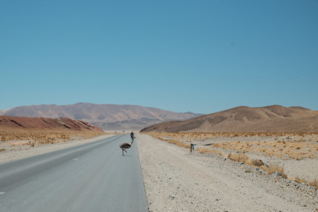
The tap water at the tourist information centre was salty so we filled up our bottles for the night at the worker camp opposite. The chilly morning had warmed up significantly in the heat of the midday sun, so after a quick layer reshuffle, we finally turned off the tarmac and onto the dirt. We quickly stopped again to watch some Rhea cross the road, the closest we’ve managed to get to these fluffy Andean ostrich-like birds.
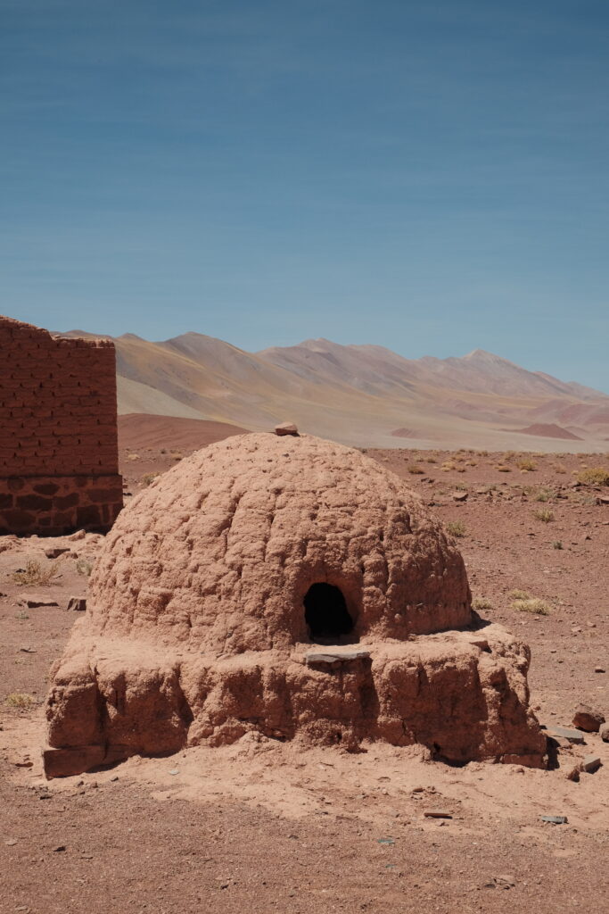
They must water the roads here with salty water from the salar as in parts the dirt is rock hard smooth. We made good time to our camp spot arriving at the ruined building at 15.30. We cracked out the solar panel and mini speaker and celebrated with some victory dancing. Evening meals chowed down in the late evening sun, the wind had dropped off and it was lovely to be able to relax a little around camp without feeling rushed by the cold, wind or dwindling light.


Day 5, 65km, Abandoned Building POI to Salar Pocitos
The night was a lesson in always pitching your tent with wind shelter even when it doesn’t feel windy. As the sun set the gusts picked up and despite good shelter from the old stone and mud brick walls, the tent was buffeted for a good few hours. Annie set off earlier than us so that she could ride unhurried and at her own pace while we fired up the stove for breakfast.
The dirt road conditions weren’t quite as perfect as the previous day with more deep sand/gravel and washboarding. The road was also surprisingly busy with trucks and pickups which presumably reflects the increase in mining activity in the area. One miner stopped to hand us a bundle of treats; we’d been waiting all trip for this to happen!
Liam stopped up ahead to watch some Rhea cross the road and a Frenchman stopped to ask Liam if he spoke Spanish and could help him figure out what the warning light on his hire car meant!
Lunch consisted of cheese and date wraps, washed down with the apple juice carton given to us that morning. The combination reminded me of my Tadcu (Welsh Grandad) who would always eat apple, cheese and dates at family picnics. Our route joined up with the railway tracks which come over Paso Socompa and we enjoyed a gentle (if slightly bumpy) descent to Salar Pocitos where we caught up with Annie. The pueblo is much bigger and busier than we expected, the upside being that we found a cafe with WiFi, veggie burgers and live election coverage that evening! We even managed to find a room for the night that wasn’t already occupied with miners.


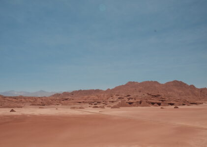
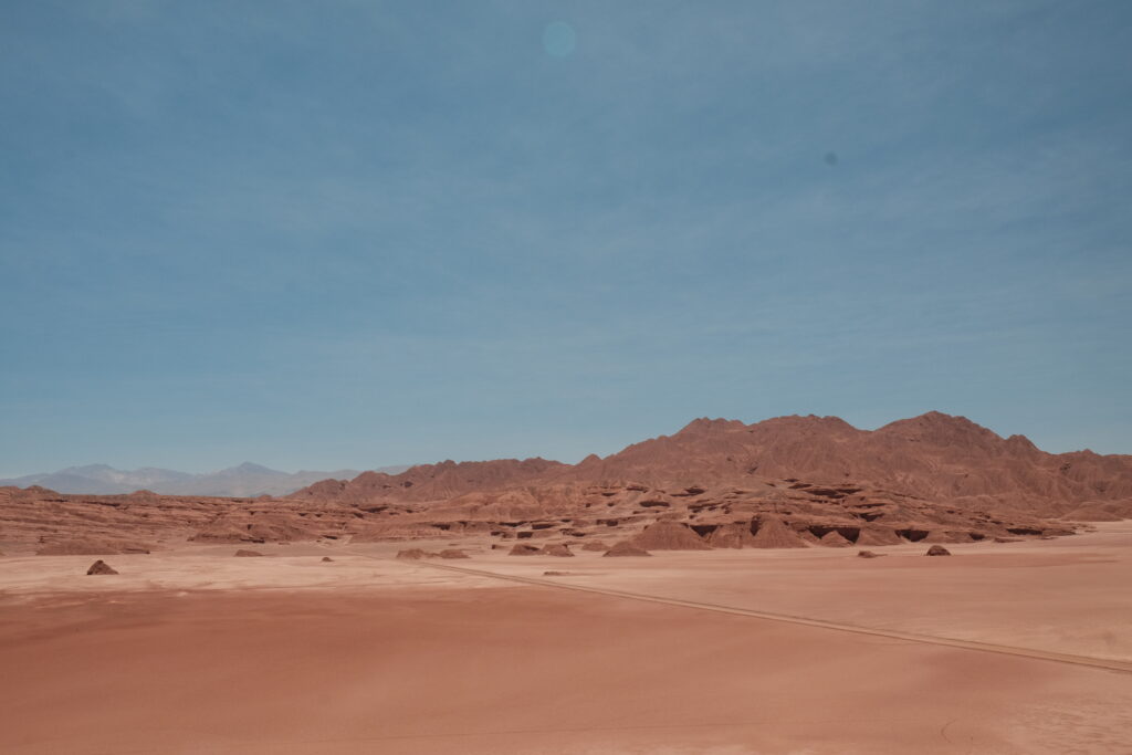
Day 6, 60km, Salar Pocitos to Abandoned Train Carriage
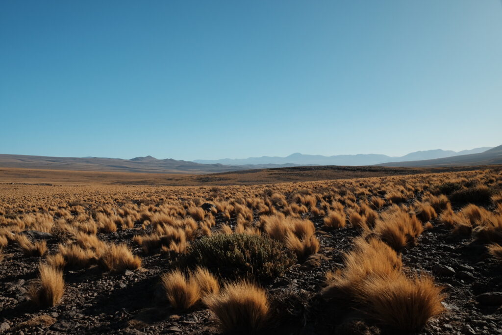
We made a quick getaway while the village was sleeping off its election hangover (Milei was good news according to the locals we spoke to) and crossed the Salar de Pocitos in the chilly morning air. By the time the heat of the day was setting in we were riding through the dramatic landscape of the Desierto Del Diablo. This was an unexpected bonus from the new route and none of us really knew what to expect. The landscape is defined by these red mounds and cliffs called Los Colorados, their unique shapes a result of the mix of metamorphic and sedimentary rocks which are shaped by the wind and (very occasional) rain. The Colorados often create small valleys for the road to wind through making this part of the route quite spectacular. With an average elevation of 3,700m above sea level and night time temperatures as low as -30C in winter the only other place on earth that’s similar is the Gobi desert.
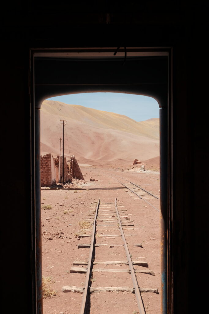
Despite stopping for many photos, we made good progress that morning and we even found some shade for our lunch stop. We needed to cool down our bodies as a 300m climb was waiting for us that afternoon. This kicked off with an impressive ascent above the desert along Las Siete Curvas, before the gradient thankfully eased off and we could cruise up to the abandoned train station at ‘km 1506’. An old train carriage was in better condition than the abandoned buildings and so we climbed on in and made ourselves at home. It felt a bit like the magic bus from the film ‘Into the wild’ with evidence of other overland travellers having stayed. Someone had even left behind a litre of water. Gracias.
It was in this train carriage that Liam and I made a terrible realisation. What we thought was a 5kg bag of instant mashed potato was actually a 1kg bag to make 5kg. This is a difference of 16 meals ladies and gentlemen. “This is why I couldn’t keep up with you” exclaimed Annie! My load was far lighter than it was supposed to be. Fortunately, we realised this error before going through Tolar Grande the following day, the last resupply point for two weeks. To add insult to injury my water bladder was leaking again and Annie’s stove was playing up. So we decided to re-jig our plans and do a very short day to Tolar Grande and have an afternoon of final faff before starting the remote part of the route.


Day 7, 30km, Abandoned Train Carriage to Tolar Grande
As we were tucking into our breakfast a train went past us on the neighbouring tracks. We’d spent a few days wondering if the tracks we’d been following were still operational and here was our answer!
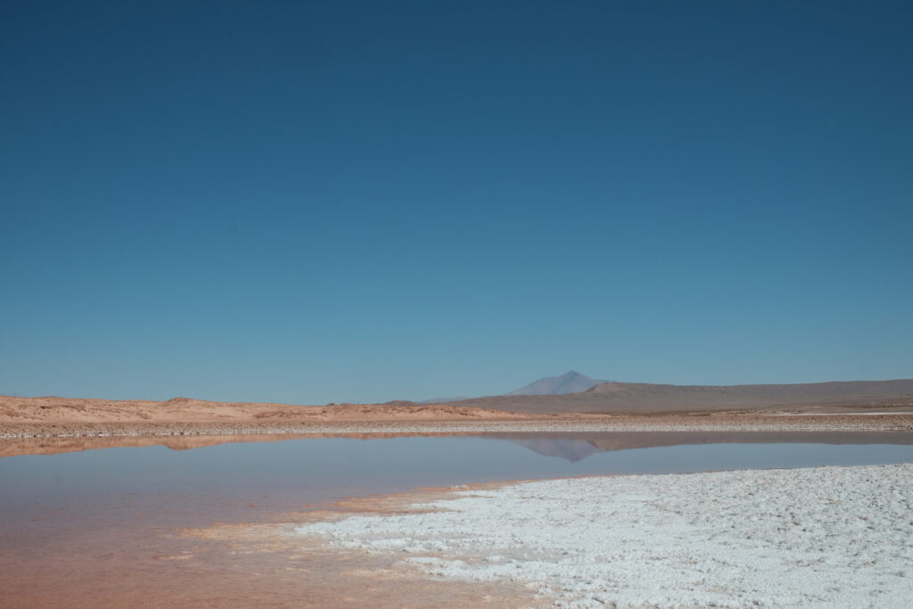
After an easy cruise downhill and a brief visit to the underwhelming Ojos del Mar we arrived in the small mining town of Tolar Grande. Liam and I raided the tiendas for pasta, crackers and biscuits and then I managed to track down a building project with some silicone sealant going spare, the advantage of South American houses always being unfinished.
We had been warned that the town is struggling to deal with the influx of mining activity and not even the hospedaje municipal had beds for the night. To add insult to injury, we were told by several people that camping is not allowed in the town because of environmental contamination, which seemed a bit rich when the land around is being milked for lithium. Thankfully, iOverlander came to our rescue with an ‘abandonated house’ and so after an overpriced almuerzo and an afternoon of hanging by the railway station (because there was a tap), we headed to our squat for the night.


Day 8, 67km, Tolar Grande to Abandoned Building POI
We actually slept pretty well in our squat and filled up our water bottles from the train station tap before leaving. The next village we’d hit would be Las Papas in 540km or 13 days’ time. The morning across the salar was quite boring and bumpy, but some miners cheered us up by insisting that we take their biscuits. After some deep, sandy gravel we stopped in an abandoned building at the edge of the lava flow for a spot of lunch. We had eyed this spot up on iOverlander as a potential camping spot but it wasn’t great so we carried on up the hill to the ruins recommended as a camp spot in the route file.
Just when we thought we were being treated to a gentle tailwind the breeze changed direction and intensified. Block headwind again. Great. We all struggled on up and were very glad to reach the shelter to be able to stop the roaring in our ears. I was exhausted and fell into a deep sleep quite early. Annie was not sleeping so deeply and was awoken by a large rodent sniffing around our sleeping bags. She shooed it away and I was glad that I slept through the whole thing!


Day 9, 30km, Abandoned building to Rocky Ruins
Lots of climbing today and the roads were loose and bumpy meaning we could carry frustratingly little speed into the uphills. We skirted along the train line again for a while, until we peeled away and towards the top of the hill reached an important water source. This reliable spring had been turned into two large swimming pools and so it was easy to collect water and eat our lunch as we watched birds and vicuña play in the stream. We filled all our bottles to capacity as this was the first of three big water carries.
There were some teething problems with the reconfigured setups for myself and Liam as we both had to retrieve errant water bottles on the first descent, leaving Annie to push ahead. When we did catch up with her at a memorial to a dead German (?!), she’d been looking at the map and suggested we take the shortcut via the Salar de Llullaillaco to cut out a day (and a pass) from the route which could be replaced by riding the out and back up to Mina Julia. Liam wouldn’t be riding with us to the abandoned sulphur mine as he had plans to attempt to summit Volcan Llullaillaco, but the shortcut worked for him too. We camped high in some ruins we found (now added to iOverlander) and enjoyed a beautiful evening up high on a tufted hillside until our petrol canister exploded in Liam’s face. It had been left in direct sunlight and when he picked it up to start assembling the stove for dinner, it had erupted like an excited champagne bottle. Thanks to our shortcut we now had a day of water to clean him up and plenty of fuel in reserve, so no long term harm done. It was just a shock. We felt a little frustrated at all the small errors and mistakes we seemed to be making, from the mashed potato to the exploding petrol.


Day 10, 50km, Rocky Ruins to Moderate Wind Shelter POI
The descent down to the salar was beautiful and cold, but as we neared the salt flats what we thought would be a small miners’ camp was in fact a huge construction operation. It felt like we were arriving on the surface of the moon but Musk and some other billionaires had gotten there early and were zooming around in their space buggies (Toyota pickups) and busy building their space modules (portacabins) and solar farms (for the giant lithium mine, this part isn’t my imagination). We were not allowed to pass owing to the huge amount of heavy machinery that was moving around. Luckily, the miners offered to shuttle us across. TLDR We would not recommend this shortcut.
We lost more time in the faff of being ferried through the construction sight than we would have taken to ride. It was here that Liam split of from Annie and myself as he had ambitions to climb Volcan Llullaillaco while Annie and I rode up to Mina Julia. We would be (hopefully) be reunited the following day in Mina La Casualidad.
Annie and I set off around the salar. With the drama of the day over, the most we had to contest with was a headwind. The POI entitled ‘moderate wind shelter’ was much better than we expected and we pitched the tent under a small cliff surrounded by mounds of sand and pumice stone. We had an excellent view of the volcano and thought about little Liam up there probably freezing his tits off and not getting much sleep!


Day 11, 41km, Moderate Wind Shelter POI to Mina La Casualidad
Annie and I rose to our 6am alarm (decided 5.30am would be too cold at our elevation) and were treated to a beautiful sunrise. We had just a short ride to the Mina Julia turnoff where we stashed our luggage in an old quarry. The main perk of these optional extra miles was to remember what it was like to ride an unloaded bike!
The road seemed well driven (washboarded) and with quite deep/loose gravel. No match for Annie’s fat bike with 4inch tyres; meanwhile I was questioning my life choices and wondering if just cruising down to Mina La Casualidad and having a rest day was a better option! The lure of cool geology and big views drew me on, and I’m grateful. Reaching the top the landscape was incredible, looking back at the lava field we’d come from, past the chartreuse yellow of the sulphur ore and across into the nothingness of the Chilean border and beyond. At 5,200m it was a new lifetime high for both of us!
We layered up and descended back down the bumpy track to our luggage and cruised down a much smoother road to Mina La Casualidad, which is where the sulphur extracted from Mina Julia was processed. We could see the old cableway used to transport ore down from Mina Julia with the buckets strewn across the ground spilling their sulphurous contents. It looked like it had been a very sudden end to mining here.
As we rounded the bend we could see the green of the spring, the vicuñas grazing here and the much anticipated church which would be our refuge for the night. Arriving here I felt like we’d reached a milestone! This church has appeared in so many blogs, YouTube films and instagram posts of this route. It felt like such an achievement to have come this far, even if our experience getting there hadn’t been as isolated as riders’ in previous years.
As the light faded a very exhausted Liam showed up – he’ll cover his volcanic antics in a separate blog post because this one is already too long! Some very gregarious mice also came out to play. Terry the altar mouse was most confident and sat above my air mattress on his hind legs taunting me. We quickly erected our tents and drifted off to sleep safe in the knowledge that Terry and his muchachos couldn’t get near us!


To be continued in Part 2…
Further thoughts on this portion of the route
Lithium mining has absolutely exploded in this region which, coupled with the diversion via Passo Jama, means the route to Mina La Casualidad is quite different to the original route. On the plus side, the roads were mainly ok (good by Bolivian standards – it depends on what your yardstick is). This portion of the route probably deserves a 6 or 7 out of 10 for difficulty (the original route was a 10/10). It would certainly be passable on 700x50mm tyres or that ballpark depending on the rider. It gets considerably harder and sandier in the next part and I will not be recommending anyone with tyres narrower than 3inches go attempting that…!
Thanks for all your detailed posts. This information will be super helpful next year (hopefully) when we are back on route. On a related note I can’t seem to get your overview map of your entire route to show up as it did before?
I think we added too many routes to RideWithGPS so it takes forever to load now. Working on a google maps alternative instead! The vast majority of our routes should be on El’s Strava account if you search for that
Great going guys. This sounds tougher than Bolivia Laguns route. Well done.
Pingback: Ruta de los Seis Miles Norte – Part 2 - drawinglinesonmaps.com